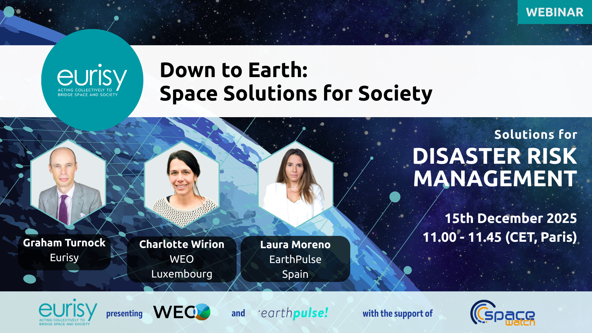
Next Session
15th December 2025
Session 3: Disaster Risk Management
Did you know that from crisis prevention and emergency response to post-disaster assessment, satellites already play a key role in monitoring and responding to both human-made and natural disasters?
As a result of global warming and rising temperatures, natural imbalances are occurring, contributing to more frequent and more severe events such as storms, hurricanes, floods, landslides, droughts, wildfires, sea-level rise, and even certain biochemical hazards. European satellite systems now give us powerful tools to anticipate these events, monitor their evolution in real time, and respond more effectively when they occur. Within minutes, Europe’s Emergency Management Service can produce detailed maps of affected areas to support rescue operations. Many private companies also offer satellite-based services, from rapid crisis mapping to continuous environmental monitoring, making these tools increasingly accessible to local authorities and organisations of all sizes.
In this session, we will explore how space-based solutions are already supporting every phase of disaster management, and how you can integrate them into your own workflow. Whether you work in civil protection, insurance, or public administration, a broad range of ready-to-use tools and services is now available to help protect communities and save lives.
By empowering responders and decision-makers, these solutions are already protecting lives and reducing the human impact of disasters.
Speakers
- Charlotte Wirion, CTO at WEO (Luxembourg)
- Laura Moreno, CEO at EarthPulse (Spain)
Learn more about them in the Speakers section!
Past Sessions
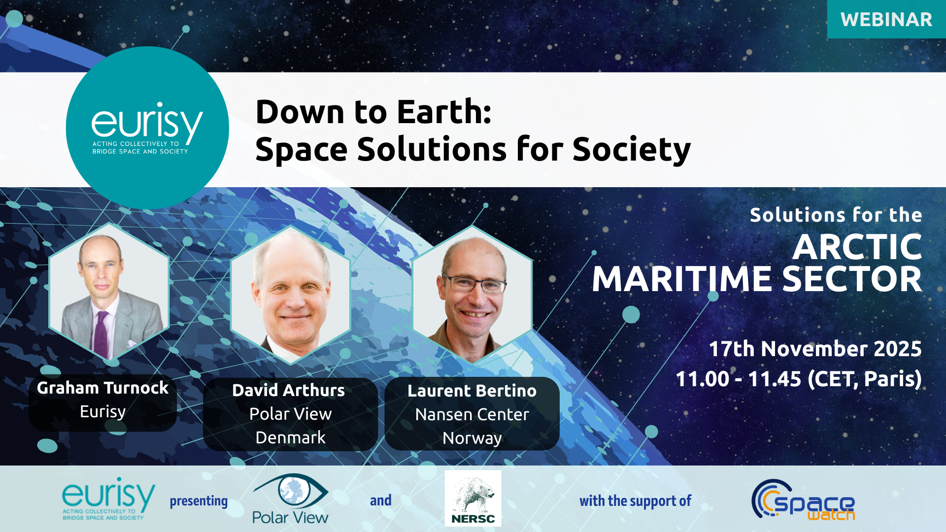
17th November 2025
Session 2: Arctic Maritime sector
Did you know that satellites help navigators monitor extreme Arctic weather, track sea ice movements, and keep vessels and research stations connected where terrestrial networks cannot reach?
The Arctic is warming faster than anywhere else on the planet. As a result, sea ice is melting and Arctic sea routes are becoming busier than ever: previously inaccessible gas fields are opening up, tourism and fishing are increasing, and civil patrols must manage growing traffic in waters where weather can change rapidly—and sometimes fatally. The region remains remote and difficult to access, making reliable tools essential for safe operations.
In this session, we will explore how space-based solutions already support civilians, navigators, and investors in the Arctic. From communication and navigation to monitoring sea ice and glaciers, space technology delivers critical data and tools to make Arctic activities safer and more sustainable.
Far from being science fiction, these solutions are available now and are already proving their value in the Arctic maritime sector.
Speakers
- David Arthurs, Managing Director at Polar View ApS (Denmark)
- Laurent Bertino, Research Director at Nansen Environmental and Remote Sensing Center (Norway)
Learn more about them in the Speakers section!
Missed the session? Here is the recording:
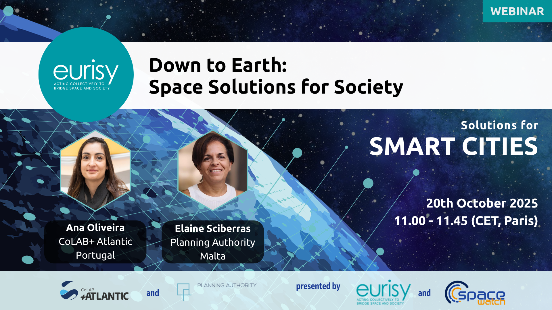
20th October 2025
Session 1: Smart Cities
Did you know that satellites can help cities track air pollution, reduce traffic jams, and even spot the hottest streets affected by climate change?
Today, more than half of the world’s population lives in cities — a number that continues to grow every year. Urban areas face enormous challenges: rising temperatures, poor air quality, noise pollution, traffic congestion, and the need for more green and energy-efficient spaces. At the same time, citizens and businesses expect cities to be more connected, more resilient, and more sustainable.
In this session, we will explore how space-based tools are already helping to make cities smarter and greener. From monitoring air quality and noise, to improving green spaces, mobility, and energy efficiency, satellite data provides practical answers to real urban challenges. Beyond cities, these tools are also driving innovation in areas like smart farming and smart factories, offering practical and long-term solutions to the challenges of climate change and urban growth.
These solutions are not futuristic visions: they already exist today and are ready to help overcome some of the challenges you face in your work.
Speakers
- Ana Oliveira, CTO for Space at CoLAB+ Atlantic (Portugal)
- Elaine Sciberras, Planning Officer at Planning Authority (Malta)
Learn more about them in the Speakers section!
Missed the session? Here is the recording: