
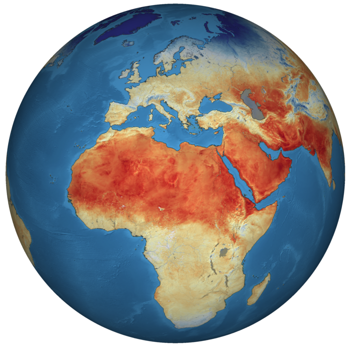
Earth Observation
Satellite images provide foundational context and visualisation of on-ground conditions, enabling critical decisions.

Satellite Navigation (GNSS)
Satellite navigation provides precise location and timing services.

Satellite Communication
Satellite telecommunication infrastructure ensures connectivity when terrestrial connections are down or inexistent.
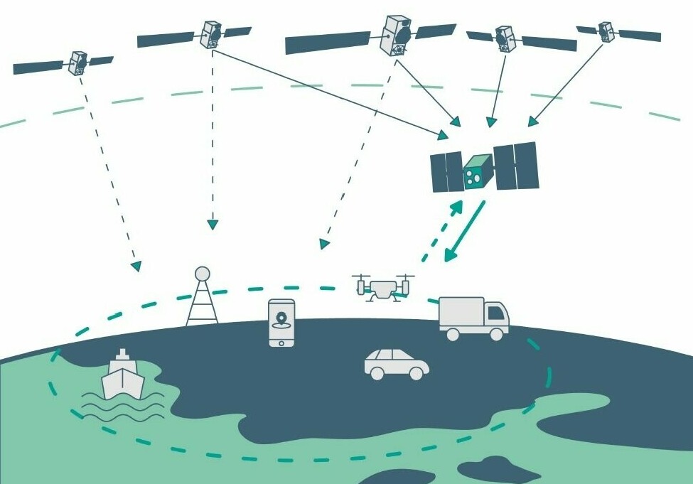
The applications resulting from these technological capabilities are often used together and in combination with data from a multitude of sources to deliver useful digital services that allow us to navigate, to make decisions, or to communicate in new ways.
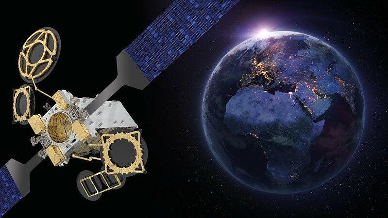
Earth observation
Earth Observation is the gathering of information about planet Earth’s physical, chemical, and biological systems via remote sensing technologies, usually involving satellites carrying imaging devices in combination with in-situ (non-space) sensors. Earth observation is used to monitor and assess the status of, and changes in, the natural environment and human landscape.
Space-based technologies deliver reliable and repeat-coverage datasets, which combined with research and development of appropriate methods, provide a unique means for gathering information concerning our planet. Examples include the monitoring of the state and evolution of our environment, be it land, sea or air, and the ability to rapidly assess situations during crises such as extreme weather events or during times of human conflict.
Copernicus - EU's Earth Observation satellite programme
Copernicus is the European Union’s Earth Observation satellite programme, looking at our planet and its environment for the ultimate benefit of all European citizens. The programme is coordinated and managed by the European Commission and implemented in partnership with the European Space Agency (ESA).
Copernicus delivers vast amounts of global data from satellites and ground-based, airborne and seaborne measurement systems to help service providers, public authorities and other international organisations improve the quality of life for the citizens of Europe.
The Copernicus information services provided are freely and openly accessible. Copernicus has become the world’s leading provider of Earth Observation data and information – a public good supporting evidence-based policies, creating economic opportunities and fostering innovation.
Data from the Copernicus Sentinel satellites covers a wide spectrum of applications. It provides valuable information for land monitoring, from urban planning to agriculture and forestry. And there is more…
Copernicus Climate Change Services
Through the Copernicus Climate Change Services (C3S), the Copernicus programme also helps to fight climate change by providing authoritative information about the past, present and future climate in Europe and the rest of the word.
Moreover, meteorological and environmental services successfully contribute to the preservation of cultural and natural heritage, for example by monitoring the effects of coastal changes. For a better understanding of the atmospheric composition and air quality, the Copernicus Atmosphere Monitoring Service (CAMS) provides data and forecasts.
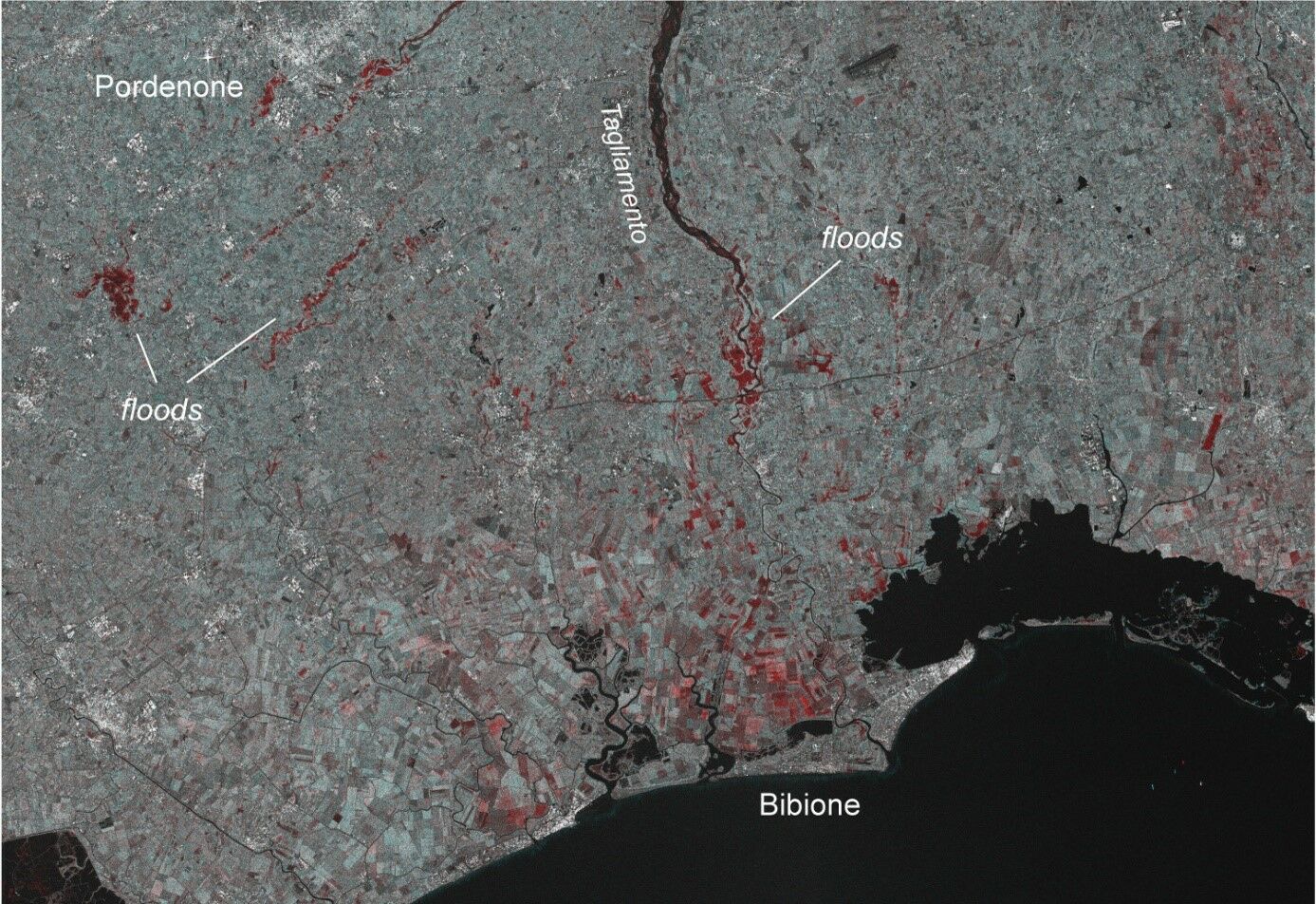
With the environment becoming increasingly unreliable and prone to natural disasters, the Copernicus Emergency Service (EMS) monitors disaster impacts and provides emergency mapping products for affected areas, helping authorities to take precautionary measures and monitor crisis situations.
With regard to marine ecosystems for the global ocean and the European regional seas, the Copernicus Marine Environment Monitoring Service (CMEMS) provides observations and forecasts to support all maritime applications including resource management, shipping and weather. Finally, the Copernicus service for Security applications supports European Union policies in crisis prevention, preparedness and response.
Did you know
- It is estimated that every €1 invested in Copernicus generates up to €10 in return.
- Producing over 16 Terabyte per day, Copernicus is the largest space data provider in the world.
- While satellites are the Copernicus superstars, the in situ component includes ground-based, sea-borne or air-borne monitoring systems deploying a battalion of mammals carrying small sensors to better protect endangered species and our planet in general!
- The Copernicus programme was named after Nicolaus Copernicus, a Polish mathematician and astronomer who changed our understanding of the Earth and the universe by demonstrating that the Earth rotates around the Sun and not vice versa.
- Copernicus satellites are called “Sentinel”, just like a guard their job is to stand and keep watch.
- There are currently 8 Sentinel satellites in orbit, flying at different altitudes up to 824 km which is twice as high as the International Space Station.
- The Sentinel satellites are equipped with multi-spectral cameras, enabling the monitoring of algae blooms, vegetation, soil moisture, and the detection of phenomena such as ground movements of a few millimetres, even through the thickest cloud cover.
Satellite navigation (GNSS)
Although satellite navigation was originally developed for military purposes, it has found its way into society creating a revolution in personal and commercial navigation. Today, the technology is omnipresent in the global transport sector, from the digitalisation of ports and railways to the guidance of innovative autonomous vehicles, as well as commercial jetliners and private airplanes, and even for the positioning of Low-Earth orbiting satellites or the International Space Station.
Satellite navigation is also a very effective tool for farmers to direct their field equipment with great accuracy, making precision farming a common term in agriculture.
As individuals we also rely less and less on paper maps to navigate from A to B during our daily activities. But finding the way with satellite receivers in our car or smartphone is just the tip of the iceberg in terms of operational satnav applications. As illustrated by our large database of success stories, satellite navigation can be used in numerous ways.
It can be used to locate distress calls for emergency interventions, or just for fun and educational mobile apps, sports performance monitoring, but also for land surveying, animal tracking, geo-tagging, and many more applications you might not expect. While we have come to take it for granted, it is difficult to imagine the workings of our world without satellite navigation capabilities!
Did you know
- A Global Navigation Satellite System (GNSS) is a group or constellation of satellites providing signals from space that transmit positioning and timing data to GNSS receivers.
- GPS (the Global Positioning System) is a GNSS constellation, but GNSS is not always GPS since there are four different GNSS constellations: GPS (United States), GLONASS (Russia), Galileo (Europe), and BeiDou (China). GPS was the first GNSS constellation which is why the terms "GPS" and "GNSS" are often used interchangeably. However, it is important in any modern discussion of accuracy of these devices to talk about overall GNSS accuracy because many devices use multiple GNSS systems at the same time to improve coverage and accuracy.
- Most devices rely on signals from multiple GNSS constellations, as well as on satellite-based augmentation systems (SBAS) such as the European Geostationary Navigation Overlay Service (EGNOS). With more satellites available, especially when they are spread evenly throughout the sky, positional accuracy improves.
- Galileo allows positioning accuracy down to decimetre level for general (non-encrypted) use.
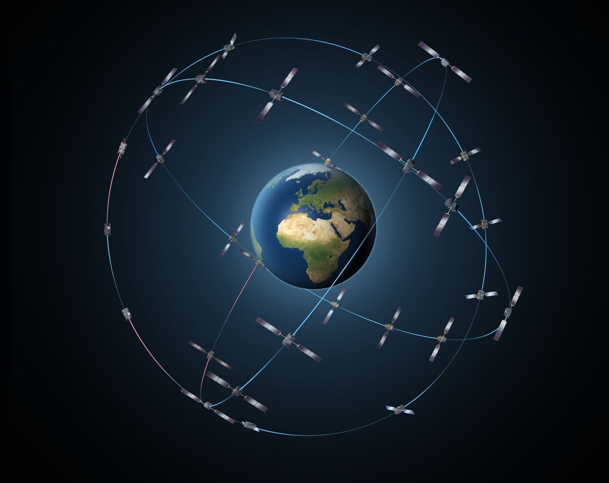
- The complete 30-satellite Galileo system (24 operational and 6 active spares), is orbiting our planet from a distance of 23 222 km. Each satellite weighs 700 kg and their deployed solar arrays span 13 m wide!
- Europe's Galileo satellites enabled the most accurate measurements ever made of how shifts in gravity alter the passing of time, a key element of Einstein's Theory of General Relativity. Moreover, their onboard atomic clocks let GNSS receivers act as a worldwide synchronised time source.
- A GNSS receiver operated by a user on Earth measures the time it takes radio signals to travel from four or more satellites to its location, calculates the distance to each satellite, and from this calculation determines the user’s longitude, latitude, and altitude.
- Europe’s GNSS was named after Galileo Galilei, an Italian scientist who stated that the heliocentric theory of Copernicus was correct, which cost him his freedom, as the Church sentenced him to indefinite imprisonment keeping him under house arrest until his death in 1642.
Satellite Communication
Satellite communications provide essential services for our daily activities. From telecommunication services including telephone calls, wireless, mobile, and cellular network providers, as well as broadcasting services including radio and television, to data communications as a significant amount of internet traffic goes through satellites.
The main advantage of satellite communication is to distribute signals from one point to many locations. Point-to-multipoint communications such as broadcasting through satellite communication does not require a lot of investments on the ground, making it ideal to overcome the digital divide.
A powerful mega-constellation of thousands of satellites
In underserved and isolated areas with dispersed populations, satellite communications bring increased internet capacities, connecting and providing affordable coverage. Satellite communications technology is especially effective during natural disasters and emergencies when land-based communication services are down.
Furthermore, satellites and other delivery mechanisms such as fibre optics, cable, and other terrestrial networks can be combined into various hybrid solutions where satellites can be one of the links in the chain in combination with other media.
Ground service providers called “teleports” have the capability to receive and transmit signals from satellites and also provide connectivity with other terrestrial networks.
In a relatively short span of time, satellite communications technology has developed into the sophisticated and powerful mega-constellations of thousands of satellites designed to bring internet access anywhere on Earth.
Revolutionising society
More than ever video, voice, and data traffic require larger amounts of bandwidth and push the continuing development of satellite technology. Satellite communication is increasingly being used for tele-education, telemedicine or videoconference systems. It has revolutionised society and continues to change the way global communication and economies work.
Satellite communications are a vital aspect of space missions as well. Telemetry tracking and command (TT&C) networks, providing a connection between spacecraft and the facilities on the ground, are indispensable for the successful implementation of space flight operations.
Did you know
- The first artificial Earth satellite, Sputnik-1, had two radio transmitters and produced a distinctive beep-beep sound which was picked up all over the world.
- The Starlink constellation, constructed by SpaceX to provide global internet access, will have at least 12 000 satellites in orbit. This is more than the total number of satellites that have ever been launched between 1957 and 2020.
- Mars is so far away that it easily takes half an hour for a message to go to the Red Planet and come back.
- Voyager 1 & 2 were the first man-made space objects to send signals back from interstellar space, more than 20 billion km from home. Talk about deep-space communication!
- Data is communicated between the International Space Station and Earth using a satellite link. Humankind still has a long way to go to take the Internet to deep space, but at least the first steps have already been taken!
- Satellite communications is the economic engine of the space industry, accounting for two thirds of overall space industry revenue.