Want to know more about our speakers?
Session 3 - Disaster Risk Management
Charlotte Wirion is the co-founder and CTO of WEO, a European climate tech company using satellite data and AI to improve climate resilience.
With a background in environmental engineering and remote sensing, she leads WEO’s technical team. Their work focuses on making environmental data accessible and actionable across public, private, and development sectors as well as to scale the projects across Africa, Asia, and Europe, with a particular emphasis on data-scarce regions and urban climate challenges.
The company has evolved from a research-driven startup into a trusted provider of high-impact environmental analytics that help communities, companies, and governments anticipate and adapt to climate risk.
Laura Moreno is the co-founder and CEO of Earthpulse, bringing more than 20 years of experience across the European space ecosystem. She leads the company’s strategic direction, guiding its mission to turn satellite-derived intelligence into practical, accessible tools for organisations that need to gain a better understanding of risks, changes and opportunities.
Before launching Earthpulse in 2020, she worked at the European Space Agency and later in the private sector, where she focused on the intersection of Earth Observation, data analytics, and real-world applications.
Her background blends rigorous technical insight, from analysing satellite datasets and modelling geospatial dynamics, with years of leadership and cross-sector collaboration. She has built teams, shaped product strategy, and driven partnerships across Europe’s space and sustainability landscape.
At her core, she is a problem-solver committed to making advanced satellite analytics a true commodity: simple to use, integrated, scalable, and impactful for decision-makers at every level, everywhere.
Session 2 - Arctic Navigation

David Arthurs is the Managing Director of Polar View and has been guiding the organization for over 20 years. Polar View is a global not-for-profit organization providing satellite-based information and data services in the polar regions and the cryosphere.
David has knowledge of the economic, policy, and strategic implications of earth observation data platforms and their contributions to user needs in a wide variety of applications. David is responsible for the vison and long-term strategy of Polar View’s ecosystem of platforms that provide information for ships travelling in the polar regions, including PolarView.aq, the Ice Logistics Portal, the Cerulean Information Factory, and the Polar Thematic Exploitation Platform (Polar TEP).
David is actively involved in the polar data community through organizations such as the European Space Agency, the International Ice Charting Working Group, SAON, and the Arctic Data Committee.

Laurent Bertino is a French applied mathematician and research leader at the Nansen Environmental and Remote Sensing Center (NERSC) in Bergen, Norway, where he leads the Data Assimilation Group. Bertino earned his PhD in geostatistics from the École des Mines de Paris in 2001.
With over two decades of experience, his work focuses on data assimilation, ocean modeling, and forecasting, particularly in the Arctic region. He is notably involved in the development and operation of ocean and sea ice forecasting models used within the Copernicus Marine Service and their utilisation for forecasting iceberg trajectories.
Session 1 - Smart Cities
Dr. Elaine Sciberras is a Maltese specialist in Geomatics, currently serving as an Executive within the Geomatics Unit at the Planning Authority of Malta. She holds a Ph.D. and M.Phil. in GIS and Remote Sensing from the University of Cambridge and has over 20 years of experience in geospatial analysis, satellite monitoring, and environmental applications.
Elaine led national and EU-level projects involving LiDAR, drone-derived data, and AI-based object detection. She represents Malta in the Copernicus Committee and User Forum and is the national contact for the European Environment Agency’s Eionet Land Systems Group. Her work also supports spatial policy development and the implementation of the INSPIRE Directive. Elaine has contributed to several scientific publications and contributes as an expert reviewer for Horizon Europe.
Through her technical expertise and collaborative approach, she contributes effectively to the use of spatial data in support of spatial planning in Malta.
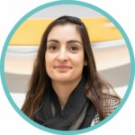
Ana Oliveira is CTO at +ATLANTIC CoLAB and an expert in Earth Observation (EO) applications, focusing on machine learning solutions for climate risk mapping and impact assessment. She holds a PhD from the MIT Portugal Programme, where she studied urban heat island effects in Mediterranean coastal cities using EO and climate data.
She is the technical lead in several international projects, including ESA initiatives (CAREHeat, MiTHO, CLIM4cities, AIR4health, XHEAT), Copernicus Climate Change Service, Destination Earth (DestinE Urban Heat-Health Forecasting, and Evaluation and Quality Control Concept), and Horizon Europe projects (ObseSea4Clim, WindTwin, TerraDT).

