IcySea: Real-Time Ice Navigation Support App for Polar Waters
Drift+Noise Polar Services
Drift+Noise GmbH was incorporated in 2014 as a spin-off company of the Alfred Wegener Institute Helmholtz Center for Polar and Marine Research (AWI) and has established itself as a reliable and valued distributor of sea ice information data.
The challenge
Ships constantly have to navigate natural elements like weather, waves, and currents. In polar waters, the sea ice in constant state of flux adds another layer of complexity which must not be neglected, as it can make navigation hazardous. On top of that, limited internet access near the poles makes it difficult for navigators to retrieve the data they need in a timely manner. Yet, having access to the right information is crucial for making quick, informed decisions that ensure both safety and efficiency.
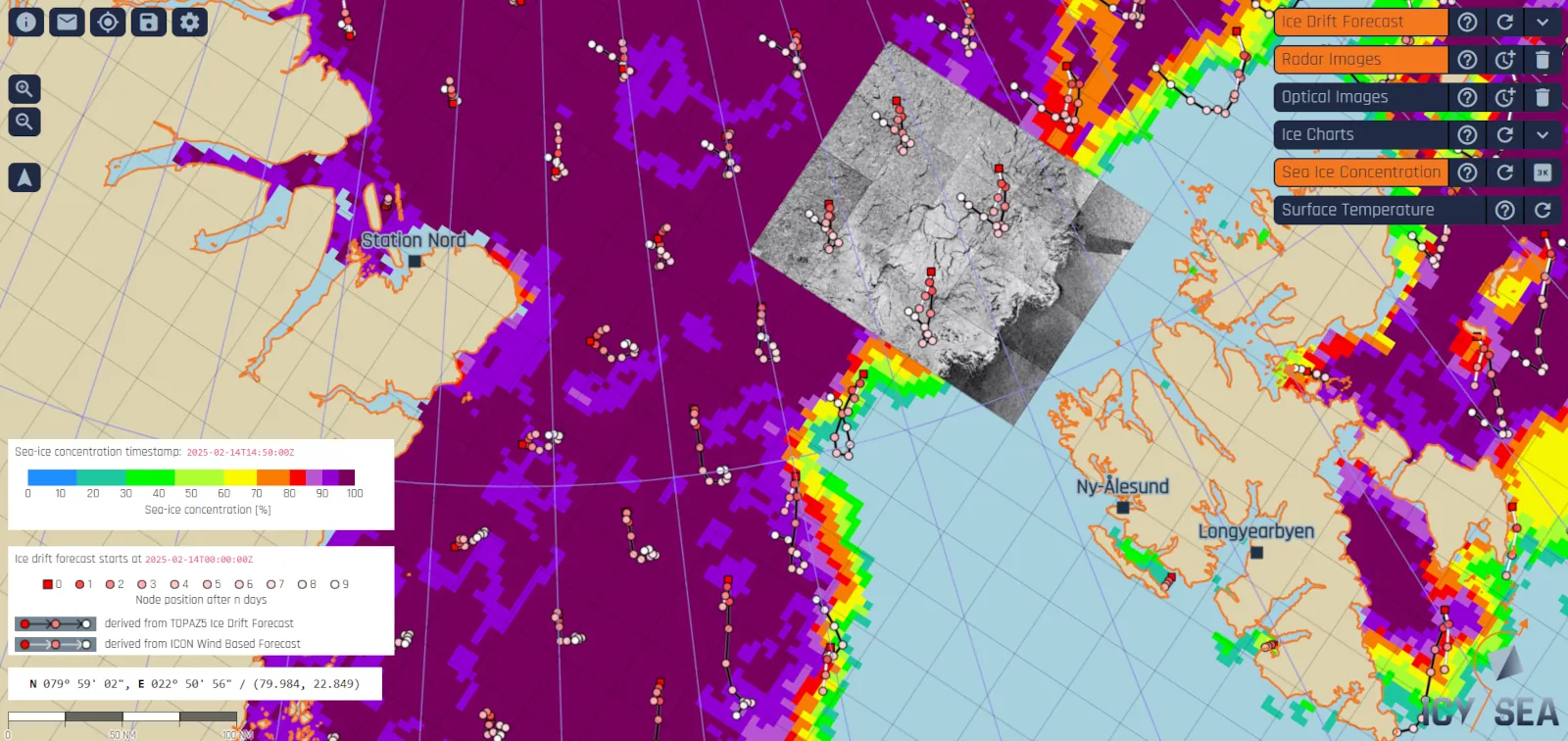
The satellite solution
Inspired by navigators’ repeated requests for ready-to-use data combinations during expeditions, IcySea offers access to the latest ice-specific satellite imagery for research, expeditions, tourism, fishing, shipping and offshore activities via a phone-sized GPS plug. The data is optimized for download in PDF format. The app is accessible and is presented through a user-friendly, intuitive and interactive interface, making it easier for crews to compare and interpret critical information while navigating icy waters. For example, users can access maps of sea ice concentration, manipulate layers and even select a point of ice on an image to forecast its drift. The app also includes a ship risk assessment tool, which evaluates the navigability of ice-covered areas depending on the vessel type entered in the system. To improve situational awareness, IcySea offers access to optical and radar satellite imagery, enabling users to monitor ice flows on clear days with optical images, or to rely on radar imagery when clouds prevent visibility. For each dataset, the app clearly indicates the most recent update time, ensuring crews always have access to the latest available information.
The results
- Reduces cost and risk.
- Instant access to ice relevant data and satellite imagery for navigators on the bridge of ships going into the polar regions.
- Time is saved because of the data processing and visualization via IcySea. Decision-making process is accelerated.
- Access to the kind of data provided via IcySea increases safety on board of ships because navigators can better assess the kind of conditions, they can expect in their target area.
- High-resolution satellite imagery simplifies and speeds up the route planning and allows ships to navigate more efficiently, save fuel and reduce travel times, which all saves the operator money.