From reactive to proactive disaster management: the DroughtWatch Portal
GeoCodis Ltd.
GeoCodis Ltd. is a high-tech Slovenian company specialising in Artificial Intelligence (AI), Earth Observation (EO), and Geo-information Systems (GIS). The company, established in 2014, has headquarters in Slovenia with branch offices in Canary Islands, Spain, and Uganda. The team of EO-specialists and software developers has developed tailored AI models that enable efficient analysis of large datasets, providing clients with a competitive edge. In the field of Earth Observation, GeoCodis has played a key role in numerous projects that transform satellite data into applicable solutions. Whether addressing water resource monitoring, urban development, or land use management the company leverages raw geospatial data to support critical decision-making processes across various domains. GeoCodis already collaborated with major organisations such as the European Space Agency (ESA), the EU the German Corporation for International Cooperation (GIZ) and others commercial clients.
The challenge
Droughts are becoming more frequent and severe, with widespread impacts on agriculture, water supply and ecosystem health. Yet, governments and agencies struggle to track the impact and effectiveness of drought management policies in real time. Without accurate and timely insights, decisions often remain reactive rather than proactive. In many places, persistent dry spells and soil-water deficits undermine both agriculture and water security: over the past few decades, Slovenia has experienced at least seven major agricultural droughts, many of which caused hundreds of millions of euros in damage.

The satellite solution
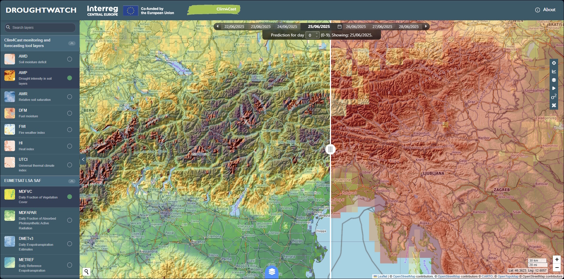
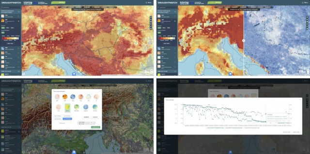
To address this challenge, GeoCodis, through the DriDanube consortium and in line with the Clim4Cast project, developed the DroughtWatch portal. It provides users with spatial and temporal view of several drought-related datasets and indices, including vegetation and drought indices, precipitation and temperature datasets and integrates estimated drought impacts, using satellite data and analytical tools.
The platform brings together information from several sources developed within Clim4Cast project and EUMETSAT products. Indices such as heat index, daily evapotranspiration, soil drought intensity, soil moisture deficit, thermal climate index and others shows both current conditions and long-term trends in an easy-to-use interface. Users can explore how drought is developing, compare today’s situation with historic data and quickly see where risks are growing, helping them make faster and more informed decisions. The portal is mostly used to assess droughts, heat waves and potential forest fire conditions and supports proactive planning across sectors.
The results
Using DroughtWatch, government agencies and civil protection organisations benefit from earlier detection of emerging drought hotspots, better coordination, and more strategic planning. The tool has improved situational awareness, reduced reliance on fragmented data, and enabled more efficient resource allocation. As a result, Slovenian Environmental Agency (ARSO) is using the portal mainly to monitor droughts and report on possible developing droughts in SE Europe region due to its role as host of Drought management centre for SE Europe. The portal allows visual and numerical comparison of various drought-related indices as well as generation of timeline animations. It currently profits from ARSO and other regional institutions’ involvement in recent projects such as Clim4Cast and Eumetsat’s LSA SAF. DroughtWatch is designed in the way that inclusion of new sets of data layers is relatively straight forward and expected as regional cooperation evolves and requires new information.