MARE: Monitoring drought at a high resolution in Catalonia
Institute of Space Studies of Catalonia (IEEC)
The Institute of Space Studies of Catalonia (IEEC — Institut d’Estudis Espacials de Catalunya) promotes and coordinates space research and technology development in Catalonia for the benefit of society. IEEC fosters collaborations both locally and worldwide and is an agent of knowledge, innovation and technology transfer. IEEC’s engineering division develops instrumentation for ground- and space-based projects, and has extensive experience in working with private or public organisations from the aerospace and other innovation sectors.
Aigües del Segarra Garrigues
Aigües del Segarra Garrigues, S.A. (ASG) is the private company commissioned to carry out land consolidation works, as well as to draft projects and execute, operate, and maintain the irrigation distribution network of the Segarra-Garrigues System (Lleida, Catalonia). It covers a gross area of 105,000 hectares, of which 64,995 are designated as net irrigable area.
isardSAT
isardSAT is an R&D enterprise founded in 2006 in Barcelona with the mission to improve the knowledge of planet Earth through remote sensing. It carries out scientific and technological projects, developing on-board and on-ground algorithms with special attention to altimetry and passive microwave missions. isardSAT prototypes algorithms for data processing for scientific applications to bridge the gap between science and decision-making, with a focus in agriculture, forestry, cryosphere and coastal areas.
The challenge
Mediterranean agriculture is one of the most vulnerable to the impacts of climate change, facing a tendency of rising temperatures and a downfall of precipitation. These conditions increase evapotranspiration and reduce soil moisture, leading to an intensification of the crop’s hydric needs. These transformations are straining agricultural irrigation capacity and exacerbating competition for the region’s limited water resources in Catalonia.
A stark example occurred during the 2022–2023 drought, when the closure of irrigation channels in the Lleida region threatened the survival of fruit trees, led to the loss of non-irrigated stands, and significantly diminished agricultural yields. The MARE project has focused on the irrigation communities of Aigües Segarra-Garrigues (Lleida) and Terra Alta (Tarragona), Catalonia, with the aim of optimising agricultural irrigation and ensuring efficient water resource management.
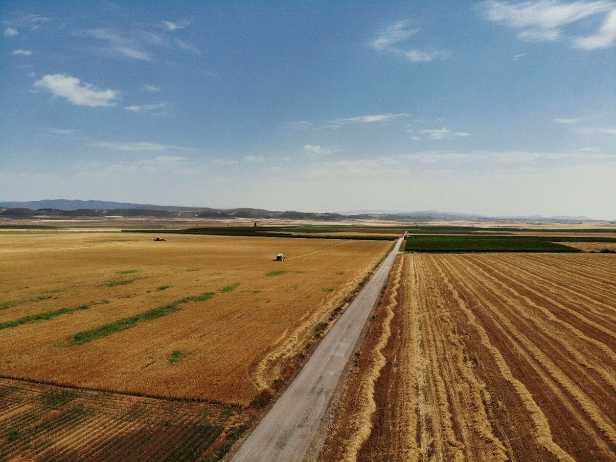
Agricultural fields in the Lleida region © ICGC

The satellite solution
Using data collected since 2015 by NASA’s SMAP and Landsat satellites, and new algorithms developed by isardSAT, MARE has created maps showing a new drought index and weekly estimates of soil moisture in the studied agricultural areas. These estimates have been validated using in-situ sensor measurements. The MARE project was part of the first ‘Earth Observation Use Case Ideas Competition for the Private Sector’, coordinated by the Institute of Space Studies of Catalonia (IEEC — Institut d’Estudis Espacials de Catalunya) in collaboration with the Institut Cartogràfic i Geològic de Catalunya (ICGC). This initiative is framed within Catalonia’s Space Strategy, promoted by the Secretariat for Digital Policies of the Ministry of Business and Labour of the Government of Catalonia.
The results
The MARE project has developed an innovative methodology using satellite data to deliver a comprehensive view of drought conditions and crop water needs.
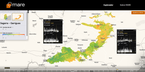
It has generated weekly maps with an innovative resolution of 100 meters, which makes it possible to anticipate water availability for crops and assess soil moisture levels compared to the 10-year historical average (to determine whether it is drier or wetter). The 100 m resolution maps reveal soil moisture heterogeneities within the same crop field, facilitating the efficient management of irrigation and fertilisers. This information is essential for maximising water use efficiency and supporting evidence-based decision-making.
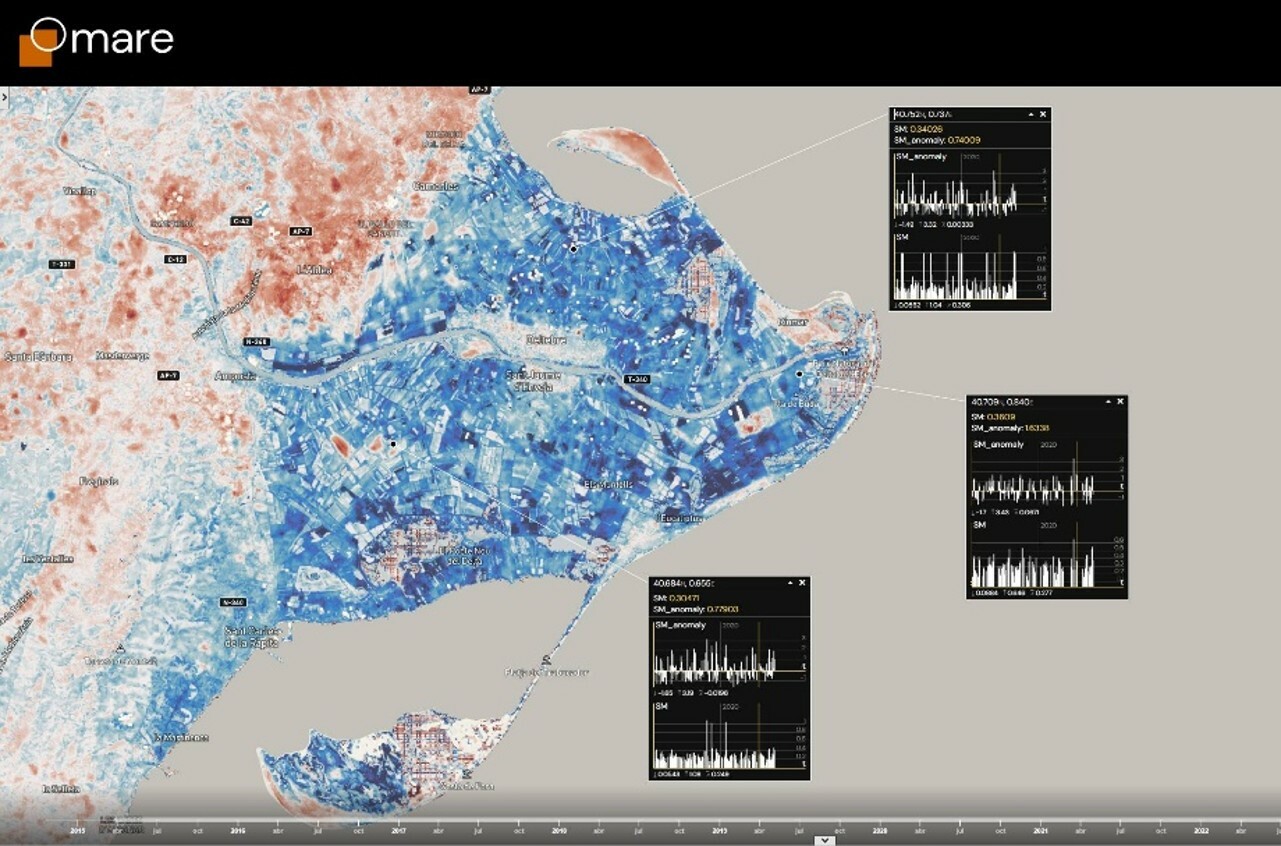 The weekly maps are available on the MARE explorer, which allows zooming in on the different areas of interest, comparing values from different weeks, or adjusting the data to improve the visibility of the selected parameters.
Access here the platform: Explorador d’humitat del sòl | Mare