Belgian Space Applications for Disaster Risk Management Showcased Under the Shadow of the Dinosaurs
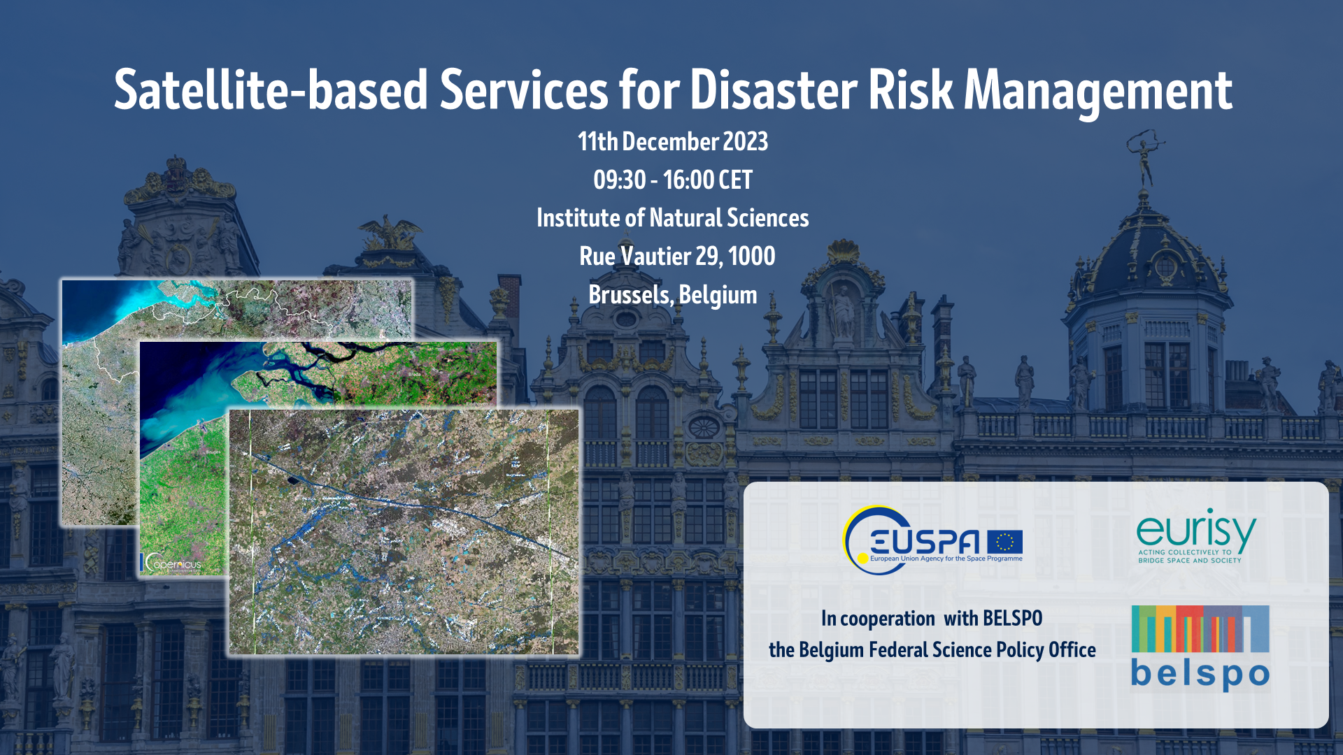
For many millions of years, many millions of years ago, dinosaurs ruled the Earth. Until one day, they didn’t. Unlike modern day humans, dinosaurs did not have satellite technologies to protect themselves. Unlike the dinosaurs, however, our greatest threats today come from within our planet, from climate change, extreme weather events, earthquakes, as well as human-caused disasters. The fossilised and skeletal remains of our planet’s old inhabitants at the Institute of Natural Sciences in Brussels are therefore a clear lesson on the need to protect our blue pale dot, and thus provided fitting backdrop for the workshop on “Satellite-Based Services for Disaster Risk Management” on the 11 December 2023. Organised by the European Union Space Programme Agency (EUSPA), in collaboration with Eurisy and the Belgium Federal Science Policy Office (BELSPO), the workshop aimed at bringing together high-level decision-makers and policy experts, a range of service providers, as well as representatives of end-user communities. By fostering dialogue and understanding of both the capabilities on offer, as well as the needs and requirements of users, the workshop series supports Eurisy’s core aim of bridging space and society.
The Belgian edition of the workshop has been particularly timely, coming as Belgium will take over presidency of the Council of the European Union from January to June of 2024. Belgium itself has recently faced a series of disaster events linked to the increasing threat of climate change. In July 2021, Belgium, the Netherlands, and Germany were struck by flooding, with much of the Wallon region affected. The flooding led to the deaths of 43 people in Belgium and caused approximately €3 billion in damages in what Interior Minister Annelies Verlinden called “one of the greatest natural disasters our country has ever known”. In just a month before the workshop, Belgium would activate the Rapid Mapping component of the Copernicus Emergency Management Service (CEMS) as flooding struck the multiple locations West Flanders region. Here the CEMS supported response efforts, using space data from the European Union’s Copernicus programme to provide delineation of the flood extent over vast swathes of area quickly, and in a clear, accessible manner for responders and decision-makers.
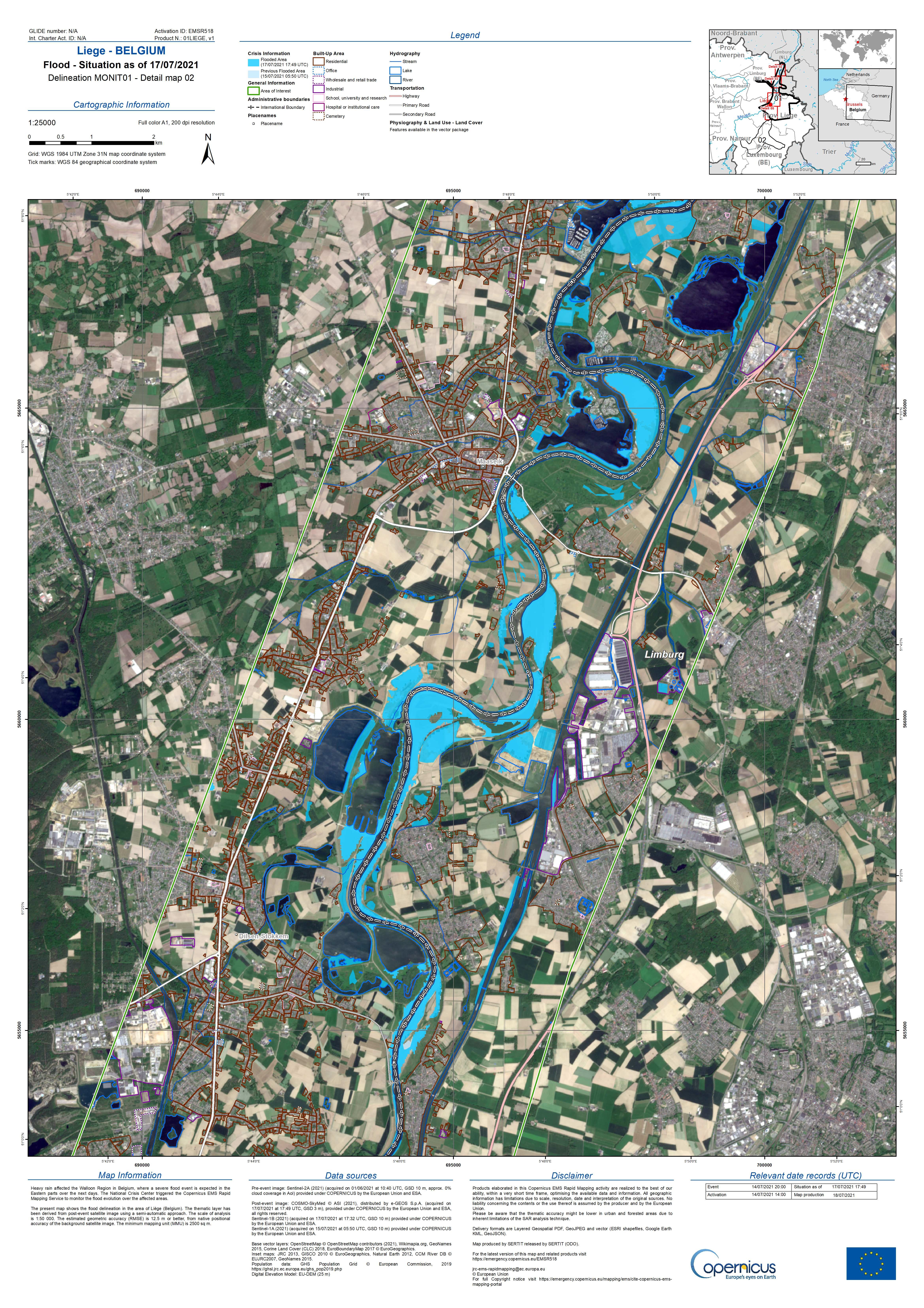
Delineation map produced by CEMS during flooding in Liege, Belgium on 17 July 2021. Image taken from CEMS.
A high-level policy panel opened the workshop with Frank Monteny, Director General of Research and Space at BELSPO encouraging participants to engage in continuous multidisciplinary dialogue to highlight current capabilities, promote integration within services, and ensure services and capabilities meet the expectations and challenges of a diverse range of stakeholders. Christoph Kautz, Director for Satellite Navigation and Earth Observation in DGDEFIS of the European Commission, highlighted the EU Space Programme’s capabilities towards disaster risk management, including CEMS, and the upcoming Galileo Emergency Warning Satellite Service. The three pillars of the EU Space Programme were further elaborated by EUSPA Executive Director Rodrigo da Costa, as a mission to exploit, secure, and foster space use for European citizens’ well-being, emphasising user engagement as a core activity. Finally, Dominique Tilmans, Eurisy President, stressed the imperative to inform decision-makers about the potential of satellite technologies to address natural disasters, particularly in the context of Belgium’s specific vulnerabilities.
The EU Space Programme supports a range of services overseen by EUSPA utilising data from Earth Observation, Navigation, and Communications satellites. Copernicus enables the Copernicus Emergency Management Service (CEMS), providing risk and recovery mapping as well as a rapid mapping service to authorised users during disaster events. The CEMS has become increasingly necessary due to increased climate-related events, and so increasingly utilised, with 2023 one of the busiest for the service in its 11 years of operations. The Galileo programme is supporting two burgeoning services saving lives, the ever-improving Search and Rescue (SAR) component as well as the upcoming Early Warning Satellite Service (EWSS). Where SAR allows localisation and increasingly sophisticated communications from emergency beacons to first responders using the Galileo satellites, the EWSS enables governments to provide early warning messages to citizens based on their devices’ precise location, even if terrestrial networks are damaged or inoperable. For the EU’s increasing involvement in satellite communications, they have built the requirements of the GOVSATCOM service for secure government satellite communications on the basis of end-user needs and use case analyses through the ENTRUSTED network project. By providing and supporting a centralised hub for governments to access a shared pool of secure communications services during crisis situations, the EU can facilitate a quicker, more efficient and cost-effective response, ultimately saving lives.
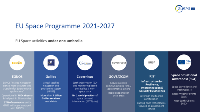
The EU Space Programme Activities. Image taken from presentation of Rodrigo da Costa, Executive Director of EUSPA.
Within Belgium’s growing space sector is an array of downstream service providers, new and established, developing applications utilising satellite data to help monitor and tackle the set of risks Belgium faces from disasters and emergencies. During the workshop six service providers demonstrated their satellite-based solutions supporting disaster risk management.
Jose Torres of Telespazio BE presented their efforts for using space data to address disasters and decarbonization, focusing on their Space Acting for Decarbonisation (SA4D) providing real-time analysis and simulation to mitigate flood risks in urban areas. VITO presented TerraFlood, using Copernicus Sentinel-1 imagery to map floods. Sentinel-1 provides Synthetic Aperture Radar (SAR) imagery, which is not affected by cloud cover and reflects water in specific, identifiable ways, enabling them to image and map flooding extent. SAR can also be used to analyse ground displacement, important for monitoring areas at risk of landslides or earthquakes. SpaceBel, represented by Romy Schlögel, showed how SAR interferometry, where two satellite images taken of the same place from different points in the sky, can enable time-series monitoring of ground movement supporting the evaluation of earthquakes and enabling continuous remote monitoring of critical infrastructure. Another innovative use of SAR satellite data was given by Serge Habraken, a professor at the University of Liege, for mapping wildfire damage, particularly useful in remote areas where satellites are the only such monitoring available. What is really being measured, Habraken explained, is the loss of information between satellite images, showing a scene change on the ground that may be due to human activities, vegetation changes, fire damages, or flooding.
Mohammed Iranmanesh of ConstellR discussed the company’s daily land surface temperature data service using high-resolution satellite imagery, using the infrared part of the spectrum rather than the optical segment which is visible to our eyes. Infrared can detect changes on plant health, in particular water stresses, up to weeks before visual images, allowing users to take corrective or remedial action earlier before potential issues from draughts or infestations cause serious impacts. One of the more visible natural disaster risks, volcanos, can create risks to aeroplanes when they erupt, generating great plumes of smoke and ash hundreds of kilometres high and wide. Nicolas Clerbaux from the Royal Meteorological Institute of Belgium introduced the NAMSAT project to monitor volcanoes and wildfires using satellite data, with a focus on early volcano eruption detection to protect aviation. Last but not least, Jean Emmanuel Roty from AerospaceLab, founded in Belgium in 2018, presented their four satellite services for disaster management, emphasising the need for sensor diversity for effective crisis response.
On reflecting on how to best connect with decision makers and societal end users to provide a service based on their needs, the panellists discussed how to bridge the gap between, on the one hand, the highly technical data from satellites and knowledge needed to interpret it, and on the other, decision makers and end users, who are most concerned with what benefits satellite data can bring and how they can implement the insights it produces. Some suggestions focused on supplying decision-makers and end users’ knowledge on the range of use cases of satellite technologies in their own area of expertise, as well as how to interpret satellite data depending on their specific contexts. Others took a different approach, Jurgen Everaerts of VITO, one of the largest providers of satellite services in Belgium argued that “nobody should be looking at satellite data at all”. Rather service providers should focus on providing user-based advice using satellite imagery, turning data into actionable insights andguidance.
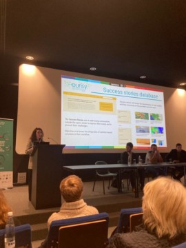
Annalisa Donati, Eurisy Secretary General, showcasing Eurisy’s success stories database.
It was then the turn of a selection of Belgian end-users themselves, to discuss how they have implemented satellite data in their work and lessons they have gained from this. With over 30 years of experience connecting service providers with end-user communities, Eurisy’s Secretary General Annalisa Donati provided a segue on the association’s work on this. One of the ways Eurisy accomplishes this is through building and maintaining the largest database in Europe of success stories where satellite technology has been implemented to solve a particular challenge. One example provided was using land cover mapping to monitor and prevent flooding in Wallonia, where the local public authority had gained a better understanding through satellite data which areas were more at risk of flooding.
Belgium’s disaster management system, BE-Alert, currently utilises various alert channels, including SMS and an internet presence. One of the challenges they highlighted was Belgians multilingualism, especially in Brussels which hosts a large international community, as well as the administrative complexity of Belgians high number of municipalities. Because of these, and other possible benefits, they are exploring possibilities of the Galileo Early Warning Satellite System, which provides alerts based on the devices location in 25 languages depending on the devices’ preference.
The Institute of Social, Economic and Political Sciences (ISSEP) provides an important link between authorities and space applications. Benjamin Palmaerts from the ISSEP discussed the institute’s integration of EO data in environmental monitoring services, collaborating with public institutions and industry in Wallonia. One such project FLOWS aims to incorporate EO, AI, and user-generated data for flood prevention and crisis management, integrating these into a single product highlighting particularly vulnerable populations and facilities alongside damage assessments.
Whereas the evidence Earth’s tumultuous past on display at the Institute of Natural Sciences provides a reminder on the fragile nature of life on our planet, so too should the increasing frequency and severity of climate-related disaster events serve as a clear warning on the future of humankind, and our impact on our environment. The consequences of climate change will continue to reveal themselves at growing human and economic costs to society. Satellite-based services, like those demonstrated at the event, can provide crucial support in preventing, preparing, responding to, and recovering from disaster events. Increasing understanding and dialogue between service providers, end users, and decision-makers on the needs, benefits, and experiences to overcome the challenges of implementing satellite applications is a continuous but necessary process to protecting and saving lives in Belgium and beyond.
Do you work in the field of environmental protection?
Are you a civil security operator?
Are you using satellite data? are you planning to do so in the future?
Then make your voice heard and tell us which are the most pressing needs of your sector in terms of innovation and data or what are the current barriers in the integration you are facing by taking the survey below. It will take about 5 minutes!
TAKE THE SURVEY