Can Earth Observation technology become a tool to contribute to the implementation of a sustainable blue economy?
In January Eurisy attended the European Space Agency’s (ESA) Workshop “Atlantic from Space”, that took place in the premises of the National Oceanography Centre in Southampton, UK.
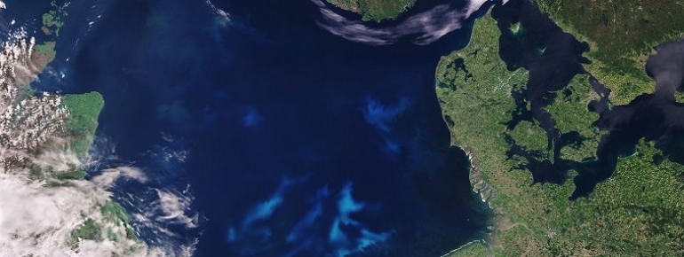
The workshop focused mostly on the use of Earth Observation data and technologies for the Atlantic region. The Atlantic a fertile region and the emerging industry sector in the area is characterised by cutting-edge science and technologies, in particular from satellite technology, tracking and imaging. The workshop, from the 23rd to the 25th of January, consisted in joint panels and parallel sessions on the macro topics of Science, Applications, Data Management and Platforms.
Eurisy participated in the Applications sections and in particular the session focused on the EU Maritime Spatial Planning and the Blue Economy. The Eurisy presentation concentrated on the blue economy and how Earth Observation can be considered as a tool in the implementation of a sustainable blue economy.
Recently, the so-called “blue economy” has become a popular topic for discussion. According to the 2018 Annual Economic Report on EU Blue Economy, it comprises all the economic activities related to oceans, seas and coasts, that cover of established sectors (eg.: Aquaculture, fisheries, coastal tourism, maritime transport, etc.) and new ones (eg. Blue bio-economy and biotechnology, coastal and environmental protection, etc.) It is important to define what “blue economy” means in order to better explain its relevance to social and economic development and why satellite technologies can be a game-changer in this sense.
Europe is developing new measures and initiatives to boost blue economy for coastal regions. Since 2014, the European Union adopted the Maritime Spatial Planning Directive, a legislation that aims at creating a common framework for maritime spatial planning in Europe. Including its outlying regions, the EU has the world’s largest maritime territory. Blue economy’s turnover is about € 566 billion, the sector generates € 174 billion of added value and creates jobs for nearly 3.5 million people. It is important to delineate measures and identifying tools to stimulate a further development of this economy.
In this dynamic and complex system, space has indeed an important role. Space systems are vital tools to support marine understanding and economic activities, improving the knowledge of the marine environment and guaranteeing innovation and disrupting new technologies. One of the key features identified in the Maritime Spatial Planning Directive is, indeed, based on the ecosystem approach, for which, data and information delivered by Earth Observation (EO) technology play an important role to better implement Maritime Spatial Planning.
The use and introduction of Earth Observation technology in the maritime sector is not something new: for instance, Operation Pakhisa, a South African government initiative to develop the blue economy across several areas, including aquaculture, relies on Sentinel 3 data.
Eurisy presented how the integration of Earth Observation, together with Satellite Navigation and Satellite Communication technologies, is proving to be effective in tackling challenges in the maritime field. One example is that of the Havarie Kommando, the German Central Command for Maritime Emergencies (CCME). This federal institution used EO combined with satellite communications and satellite navigation to respond to marine pollution, in particular to respond to oil spills in the northern coasts of Germany. The CCME used the CleanSeaNet, an oil spill and vessel detection space-based service based on satellite data, provided by the European Maritime Safety Agency. The CCME receives 600 satellite images per year, containing a classification of the dark spots detected according to their resemblance with oil spills and their potential impact. By combining information on potential oil spills and their position relative to vessels, the CCME is also able to identify the potential polluters. The use of this service played an important role in improving the surveillance capacity in case of incidents. The CCME example is significant not only because it is a clear example of the use of satellite data and technology applied to the downstream sector, but also because the benefits of using such space-based system positively affect the coastal regions economic activities, from fishing to tourism.
Another relevant application is the use of Earth Observation to spot algal bloom from space. Harmful algal bloom can have dangerous and negative consequences on aquaculture, desalination, fishing, and consequently human health. Thanks to new technologies, the combination of microscope images, buoy information and EO images, spotting algal bloom from space become easier and more effective.
There is a long list of potential applications of EO in the maritime sector. The majority of these applications have a positive impact on the human activities on the earth. As demonstrated recently in other fields, society can positively benefit from satellite technology. It is, then, important to highlight the relevance of having direct contributions and feedback from the users. Eurisy’s mission is to connect space and society. We adopt a user centric approach, in particular we work mostly on the identification of user needs and on raising awareness on satellite benefits for societal needs. What is important is to understand if the demand and supply of satellite services are properly matched to each other.
In our session on Applications, users were virtually brought into the discussion. As also explained by Mr. José Moutinho from the Portuguese AIR Centre, it is vital to communicate and interact with the end users at every level of society. It helps to better guide the service providers and to help the national, or regional or local policy makers create ad-hoc policies that would help the implementation of sustainable measures to guarantee the development of a sustainable coastal economy. For this reason, the AIR Centre, adopted an interesting tool called User Story Conversation Canvas, a questionnaire adapted to everyone. Such an initiative, like many others, is fundamental in giving a full picture of what the users, and society, need.
What has been highlighted, especially in our presentation, is that recently the demand for EO products is increasing, also in the maritime sector. However, often this demand is not matching the supply because of the high volume of research projects that rarely get to the “go-to-market” phase. Furthermore, it has been noticed that the main applications in the maritime sector are related to navigation and communication, only in combination with EO. There is then, a lack of services based exclusively on Earth Observation data. It would be useful, in the future, to target a non- traditional group of users. An example would be, for the maritime field, to target fisheries as potential end users. To make this connection easy it is important to have a clear explanation of how satellite technology, and EO in the specific, can improve their economic activity and boost their income, making the fishing experience easier, safer, and more sustainable. It is necessary to always consider that when a dialogue with non-space related sectors starts, it has to be plain. The interlocutor need to understand the pros and cons of adopting a technological tool far from his/her field of activity. If this dialogue is well structured and comprehensible to everyone, then it will be simpler for the users to finally understand the benefits derived from space applications.
Another point that we found highly relevant is the proliferation of clusters dedicated to the implementation of satellite technologies in the maritime context. They are the results of policies and initiatives at European and regional levels that proves to be effective for the economic development of coastal areas. The growing number of EO clusters in the Atlantic region demonstrates the importance of collaborations between different institutional levels, economic and financial actors and academia. It would be appropriate in the future to start from clusters’ initiatives to push forward projects that could turn into applications that would help in facilitating economic and social development in coastal regions.
The workshop was a first small step that helped us in learning more on the topic and to exchange views with the participants. We hope in the next future to continue to develop activities on the use of satellite technology for the maritime sector.