Video: Monitoring plant health from space
A new video from Eurisy and ESA highlights the potential contributions of EO data to enhance the monitoring of plant health.
Following the release in 2020 of the policy brief “Fostering the use of satellite Remote Sensing to support Plant Health surveillance activities”, Eurisy and ESA, with the scientific advice of Euphresco, realised a video showcasing possible uses of EO data to better monitor plant health.
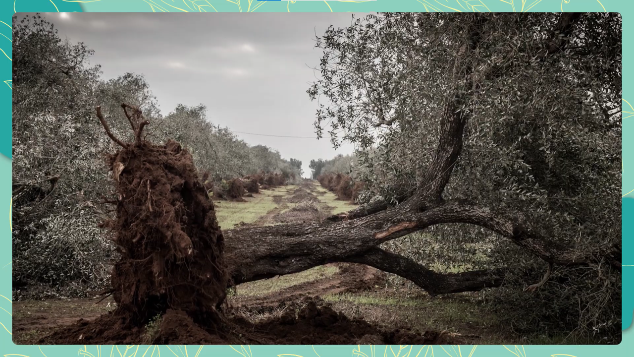
The video focuses on Xylella fastidiosa, a dangerous bacterium that caused the uprooting of 1,150 olive trees in the Plain of Monumental Olives in Apulia (Italy) in 2021, and that has become a major phytosanitary emergency for the European Union.
Xylella fastidiosa is a quarantine pest, that can cause important economic losses and rapidly spread across borders thanks to activities such as trade and tourism.
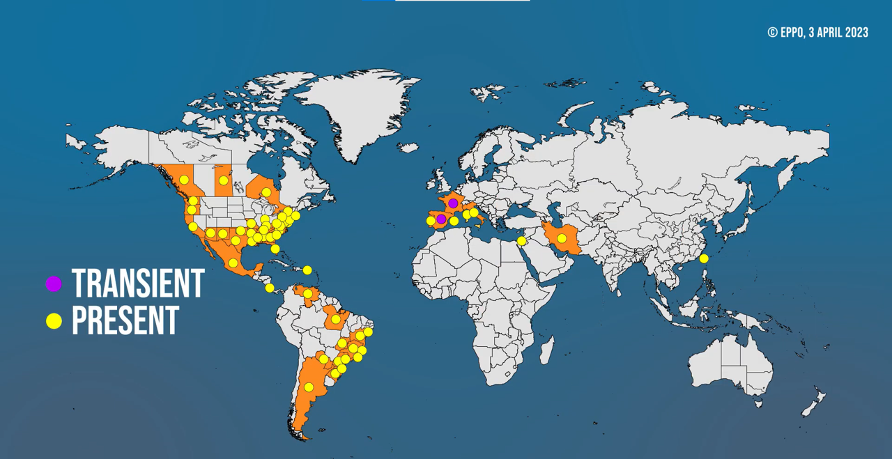
World distribution of Xylella fastidiosa. © EPPO 2023.
For example, since it was first officially detected in Europe near Gallipoli in 2013, Xylella fastidiosa has spread throughout the Apulia region, causing over a billion euros of damage to the regional agriculture and industry. If its full spread is not contained, this bacterium could cost billions to the European Union in the coming years.
What can we do to stop it? As the old saying goes ‘prevention, is better than curing’. Indeed, it is more effective and less costly to prevent the introduction of a pest in an area, or to eradicate it early on, rather than trying to contain it once it’s settled.
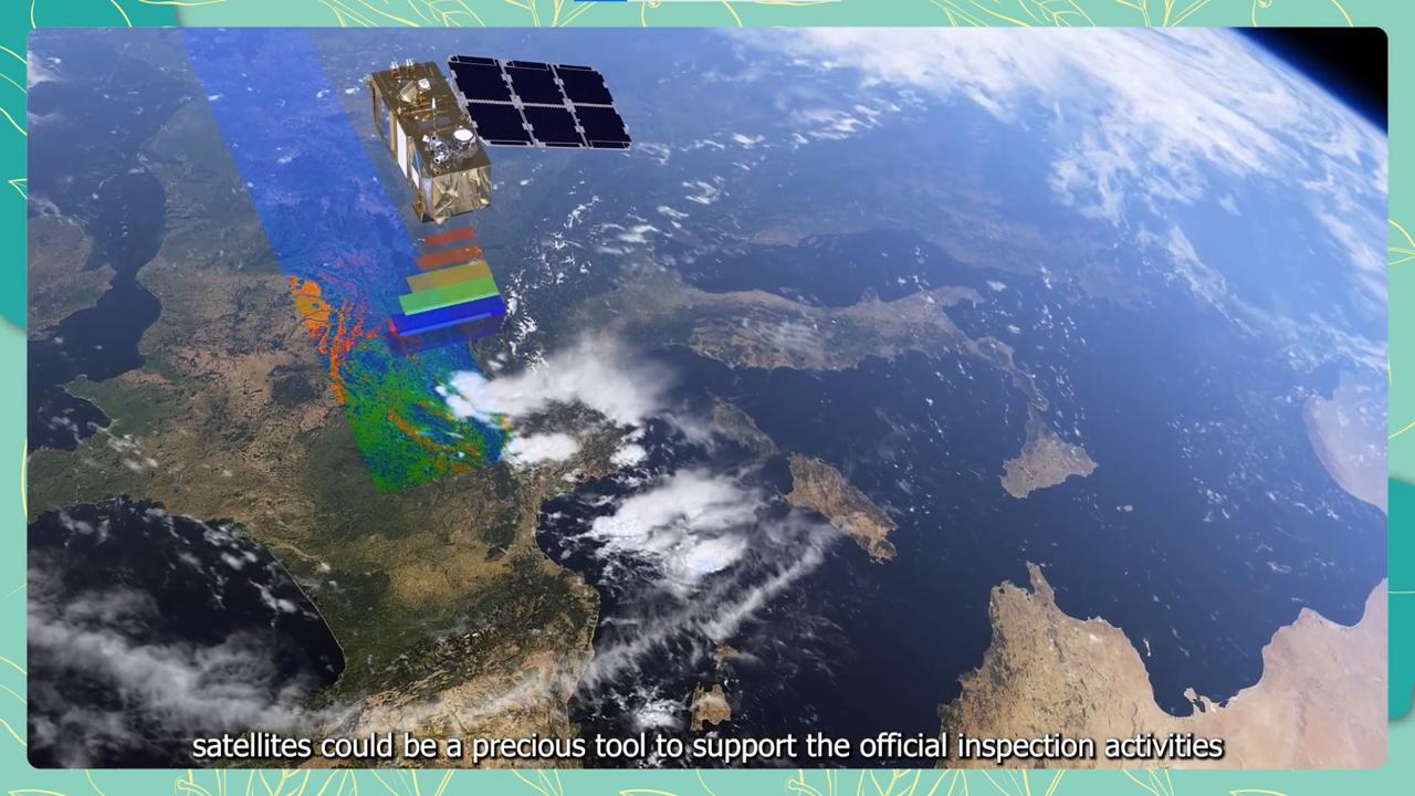
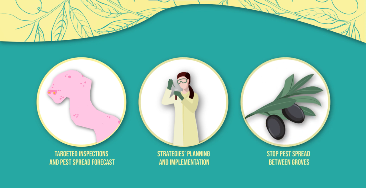
By allowing the surveillance of large areas or areas that are difficult to reach, satellites could be a precious tool to support the official inspection activities of the national plant protection organisations.
How? Satellites have sensors that can identify plant species affected by pests and help mapping and monitoring them.
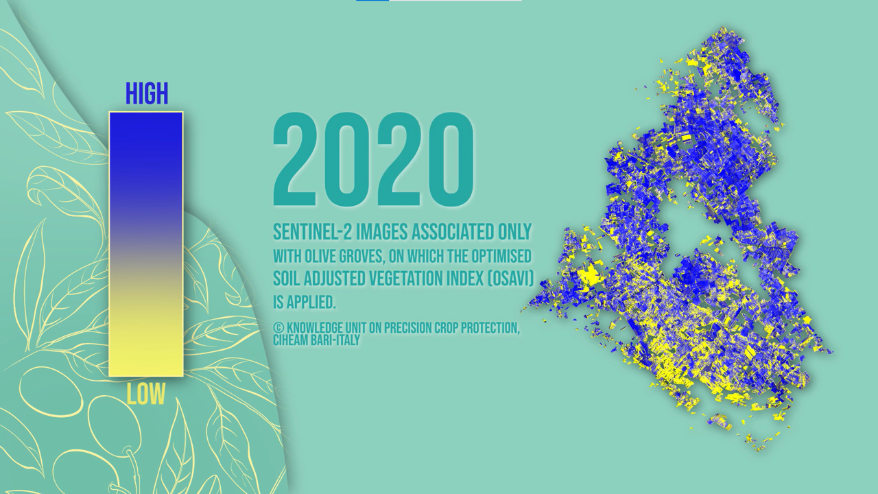
As an example, satellites allow us to visualise the spatial and temporal evolution of the Olive Quick Decline caused by Xylella fastidiosa in olive groves in the South of Apulia.
Moreover, if we understand the location and abundance of plant species that can be potential hosts for quarantine pests, we can target inspections even when symptoms are not visible to the naked eye, and take informed measures to avoid the spread of pests to areas where susceptible hosts are present. Finally, satellites can even count plants hosting pests.
All in all, satellites can be seen as the scalpel of a surgeon, because they allow for precise interventions, making monitoring faster, more effective and cheaper.
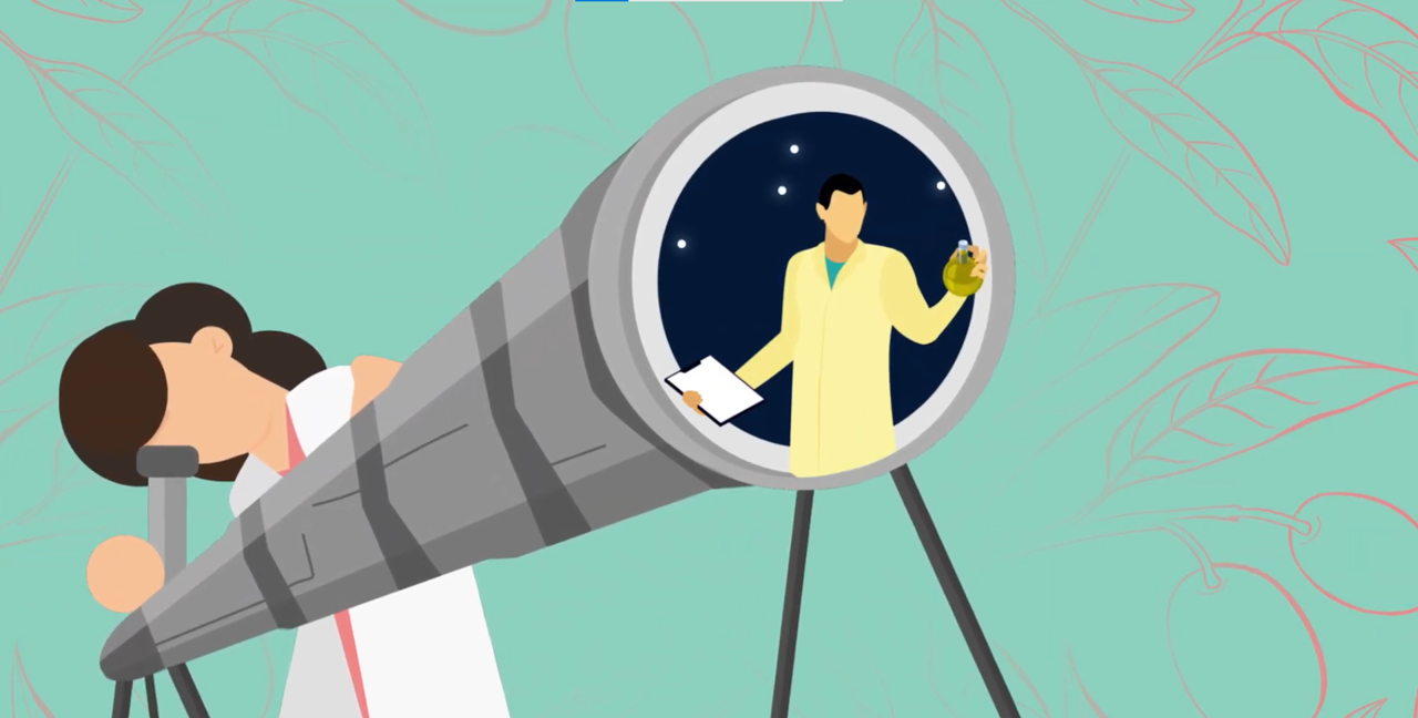
Joint research activities between phytosanitary and space experts can lead to the development of more and better applications to protect our agriculture, ecosystems and economies.
Remember that next time you see a satellite in the sky!
You can find here the policy brief “Fostering the use of satellite Remote Sensing to support Plant Health surveillance activities” produced by Eurisy and Euphresco on the occasion of the United Nations International Year of Plant Health in 2020.
To go further:
The effective role of remote sensing in detecting pests and supporting plant health surveillance, on the website of the International Plant protection Convention, posted on 4 November 2021: www.ippc.int/en/news/the-effective-role-of-remote-sensing-in-detecting-pests-and-supporting-plant-health-surveillance/
Plant health, on the European Space Agency’s website: www.esa.int/Applications/Observing_the_Earth/Copernicus/Sentinel-2/Plant_health
Euphresco’s website: www.euphresco.net