Navigating Resilience: Disaster Risk Management Insights from Sweden
Representatives from government, research institutions, civil society, public authorities such as fire and rescue services, and the private sector came together on 12 November 2025 in Stockholm, Sweden, to discuss key challenges in disaster risk management (DRM) and to explore the potential contribution of satellite technologies in this field. The event, co-organised with the Swedish National Space Agency and the Swedish Civil Contingencies Agency (MSB), was part of a series of national workshops initiated by the European Union Agency for the Space Programme (EUSPA) and supported by Eurisy. These workshops aim to raise awareness about the services offered – and wider satellite applications supported – by the EU space programme across the full range of disaster management phases, improve accessibility to these services, and gather stakeholder feedback on user needs and experiences.
Sweden faces a variety of natural hazards, including floods, storms, and wildfires. For example, in a context of rapid climate change, the areas surrounding Sweden’s extensive waterways have recently experienced an increase both in the frequency and severity of flooding events. Disaster risk management is an important national priority and space-enabled services are central to Sweden’s efforts in this area, providing critical support for monitoring, early warning, and response.
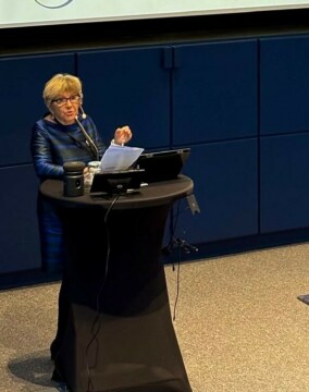
Dominique Tilmans, Eurisy president, giving her introduction speech
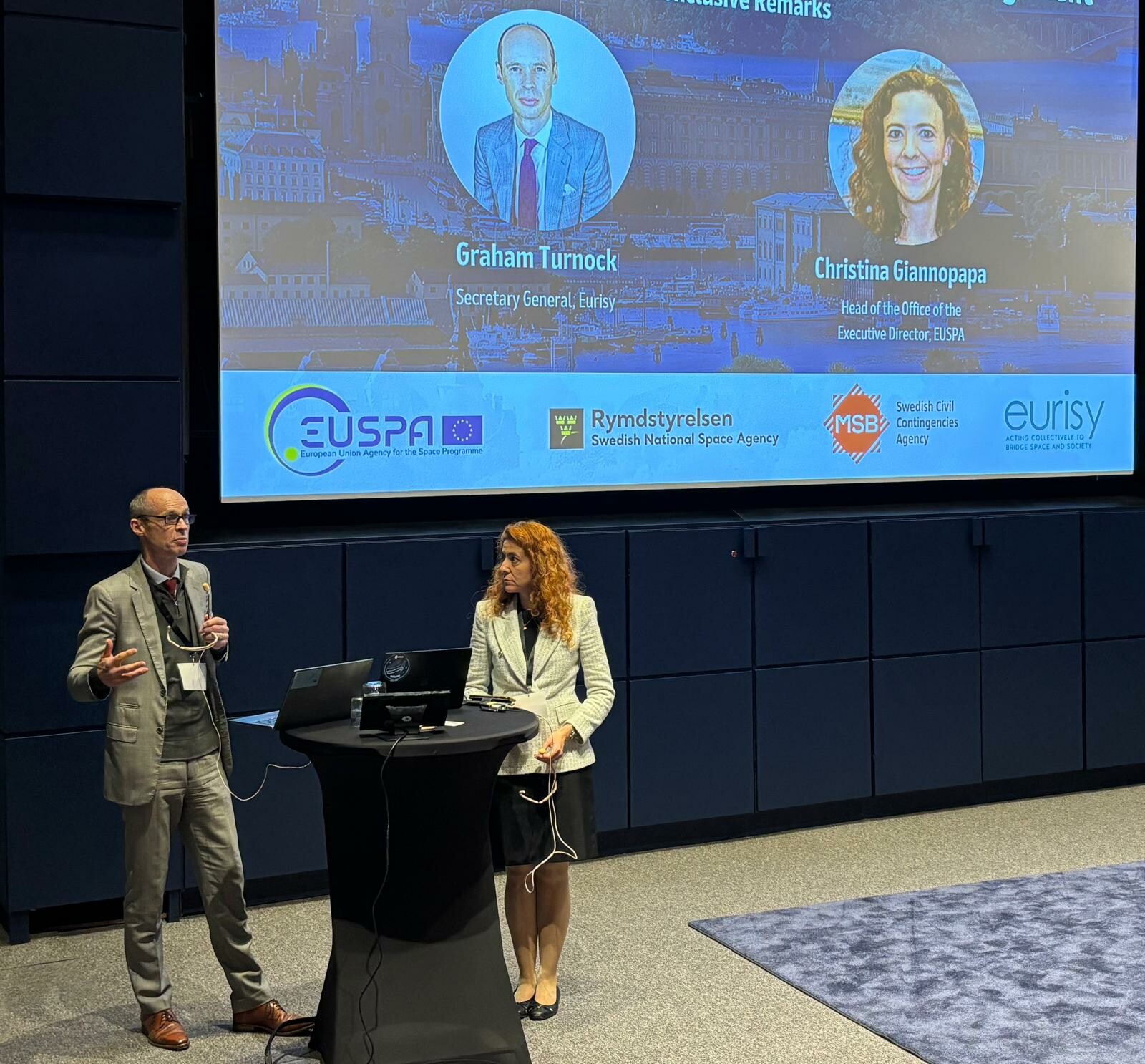
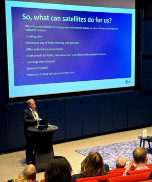
The event began with a with a strong call from Ella Carlsson, Director General of the Swedish National Space Agency, to deepen the collaboration between Sweden and European partners to ensure that satellite-based information becomes fully integrated in national disaster management frameworks and a core tool for preparedness, response and recovery. She also highlighted Sweden’s commitment to ensuring Europe’s space systems, including Galileo’s Search and Rescue (SAR) and the upcoming Emergency Warning Satellite Service (EWSS), deliver real life-saving benefits for the public. Åke Holmgren, Director of Cybersecurity and Secure Communications at MSB followed, stressing that space is already essential infrastructure for Sweden, and the immediate priorities now are to strengthen redundancy, raise awareness, and build operational capacity so satellite services fully support civil defence today – not just in the future. The critical role of the EU space technology – Galileo, Copernicus and future GOVSATCOM and IRIS2 – in DRM was emphasised by Rodrigo Da Costa, Executive Director of EUSPA. He underlined the fact that these space capabilities not only support operational effectiveness but also strengthen Europe’s security, resilience, and strategic autonomy, by enabling governments, first responders, and essential services to act quickly and reliably in crises. Eurisy president, Dominique Tilmans highlighted that space is a practical tool for public safety, allowing first responders and local authorities to access critical satellite data in near-real time. She recalled the purpose of the Eurisy–EUSPA series of workshops, noting that it aims to bridge the gap between space innovation and real-world resilience by connecting decision-makers, scientists, and first responders. Referring to Sweden’s experience with sustained wildfires in 2018, she underlined that Europe’s resilience lies in cooperation, knowledge sharing, and widespread access to satellite services – so that no region faces a crisis alone. Finally, Kristoffer Hultgren, Head of the Space Security Section at the Swedish Civil Contingencies Agency at MSB shared an operational perspective, showing how space-based services are becoming part of frontline emergency response for wildfire detection and mapping, flood risk monitoring, search and rescue and damage assessment. Noting that while the space technology to enable such services already exists, he emphasised that the challenge now is to apply that technology in practice, and build bridges from orbits to operations.
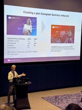
Tomas Jonsson, CASSINI Team Leader, for CASSINI Space Entrepreneurship Initiative at European Commission, presenting the EU Funding opportunities.
Following these opening remarks, a session on the EU Space Components examined how EU space assets — Copernicus, Galileo, and the forthcoming GOVSATCOM and IRIS² programmes — contribute to disaster risk management and emergency response. EUSPA representative Marie Ménard highlighted that Copernicus delivers free and open operational satellite services that support every phase of DRM. The Copernicus Emergency Management Service (CEMS) was given as a concrete example, activated during – or ahead of – floods, earthquakes, wildfires or other crisis, providing responders with highly accurate situational awareness. Other Copernicus services – including the land, climate and security services – and related tools – such as flood impact demonstrators or land monitoring for deforestation – also play an important role in DRM. A presentation Jérémie Benoist of EUSPA of Galileo highlighted how the programme enhances security and life-saving operations through Navigation Message Authentication service (OSNMA) that protects users from spoofing, the Search and Rescue service with its Return Link feature, and the forthcoming EWSS, which will broadcast alerts directly to the public via satellite when terrestrial networks fail. Europe’s Space Surveillance and Tracking network, safeguarding Europe’s space infrastructure by tracking debris, was also presented. Lastly, CASSINI, the EU’s entrepreneurship and investment initiative, and relevant Horizon Europe calls were presented. These support startups to scale faster and deliver new services for public sector needs, including for example wildfire detection and crisis monitoring. The success of CASSINI to date was underlined with a number of successful European companies active in DRM having recently been incubated and supported in significant growth. Member States were encouraged to consider whether their own national initiatives, combined with the use of European services, could be supplemented by drawing on the capabilities of such companies.
The first of two afternoon sessions demonstrated how Sweden increasingly relies on space assets across the full DRM cycle. It opened with a highlight of Sweden’s near real-time satellite-based wildfire detection system and its important operational role in national fire management. Stefan Andersson from MSB and Adam Dybbroe from the Swedish Meteorological and Hydrological Institute outlined how Swedish authorities traditionally rely on public reports and aircraft-based monitoring, with satellite technology – specifically the Visible Infrared Imaging Radiometer Suite (VIIRS) on NOAA/NASA platforms – now adding a further layer of precise early detection. This capability can detect small fires – as small as 10×10 metres – and has a wide coverage. The system processes incoming data through filtering techniques to reduce false alarms and then delivers detections through an accessible online portal used by emergency services. Since 2022, the system has identified between 35 and 61 fires annually,
with roughly one-third first detected by satellite, demonstrating the importance of space in complementing ground observations. A concrete example was given of one fire where smoke was detected but the firefighters could not locate the source for a number of hours until it was pinpointed by
satellite, considerably accelerating response time.
Björn Skoglund of Sweden’s 112 Emergency Call Centre next highlighted how satellite-enabled services have transformed emergency communications and caller localisation. Before 2019, mobile callers could be located only within broad areas – typically between 500 metres and 2 kilometres – making it difficult if not impossible to find them if they were unaware of their own location. The introduction of Advanced Mobile Location, which uses GNSS capabilities in smartphones, immediately improved precision to 15-65 metres, dramatically reducing search times and improving survival outcomes. Another example of the relevance of space assets was given in the possibility to send distress texts when the mobile coverage is absent, essential in remote regions or in case of extreme weather.
The final presentation Faramarz Nilfouroushan of Lantmäteriet and the University of Gävle broadened the perspective from immediate emergencies to long-term risk monitoring, showing how satellite radar data support proactive management of geohazards. Using InSAR and the European Ground Motion Service, researchers can detect millimetre-scale ground deformation over large areas, offering essential insight into subsidence linked to phenomena such as drying of post-glacial clays, groundwater fluctuations, and historical mining activity. Case studies from Uppsala demonstrated how urban areas built on deep clay layers show pronounced subsidence patterns, guiding planning decisions and resource allocation. The presentation also pointed to future advances, such as combining satellite time series with machine learning to automatically identify key infrastructure such as major roads threatened by ground movement. Together, the different presentations highlighted how Sweden is operationalising space technology to support DRM efforts. The session illustrated that space is an essential tool to reinforce Sweden’s ability to mitigate, prepare, respond and recover from disasters.
Bringing together experts from navigation, search and rescue, and regulatory fields, the second afternoon session examined how users and service providers are navigating both the current challenges and opportunities related to the uptake of satellite data for the users. The session opened with insights on the next generation of maritime navigation systems, where Magnus Wallhagen Sjöfartsverket from the Swedish Maritime Administration explained how the transition in the last twenty years or so from paper to electronic marine charts had marked a fundamental breakthrough, helping vessels plan and execute their voyages to more effectively, efficiently and safely by for example supporting GNSS-enabled navigation and providing real-time weather and surface current information. Looking to the future, the same speaker noted that the maritime sector will depend increasingly on secure, high-bandwidth satellite communications and GNSS for capabilities such as the detection of ship height – enabling precise real time monitoring of draught and more efficient loading for navigation in shallow waters. 
Building on this, the following presentation by Sebastian Wigmo Sjöfartsverket from the Swedish Maritime Administration on search and rescue confirmed the central role of satellite systems to save lives. Through the COSPAR system, satellite enabled distress beacons have ensured for some years that vessels in distress can be rapidly detected when out of reach of radio communications. Recently integrating the Galileo satellites into this system has considerably shortened decision and reaction time, improved localisation accuracy while also providing a return signal capability to reassure mariners that help is on its way. One operational example presented in the session showed how, in several recent emergencies, satellite alerts were received before crews were able to make voice contact with the beacon activated through contact with the water. The speaker noted how as satellite-enabled equipment proliferates, a growing mix of traditional distress beacons and new consumer satellite communication devices have become available that allow hikers, mariners, and remote workers to request help when beyond the coverage of terrestrial communications systems.
The final presentation by Peter Bergljung of Transponder-Tech AB and Ann Gyldén of Transportstyrelsen addressed the sharp rise in GNSS jamming and spoofing events affecting maritime and aviation operations, especially in the Baltic region. Since early 2024, interference incidents have increased dramatically, with investigations pointing to foreign state activity near conflict zones. Aviation has experienced cases where aircraft deviated from course due to GNSS spoofing, which was detected only because air traffic controllers noticed anomalies on radar. Maritime users face similar risks as ships unknowingly drift off their intended route. The presenters noted that detecting spoofing requires sophisticated solutions, but that these are becoming simpler and more widely available. They further underscored the broader geopolitical implications: GNSS is a global utility, and coordinated international action is required both to attribute unlawful interference and to strengthen resilience through regulatory, technological, and operational measures. Overall, the session outlined that satellite data and GNSS services are deeply embedded in modern maritime and aviation operations, but thus are also more dependent and vulnerable.
If you were unable to join us, you can find the presentations here.
Wrapping up the event, speakers in the final session underscored the clear message of the day: Sweden’s ability to protect lives, infrastructure, and essential services increasingly depends on how effectively space capabilities are integrated into civil protection and disaster risk management. Space assets are – mostly – integrated into daily operations across agencies. However, this growing reliance on space comes with new threats, such as GNSS jamming and spoofing, and more generally with space capabilities becoming key to the resilience of overall civil protection mechanisms, their own vulnerabilities must be understood and addressed. Resilience is therefore a national and collective international priority. The different sessions highlighted that to progress, strong European cooperation, sustained innovation – including through dual-use – and user-centric approaches are essential. Across all discussions, it was clear that satellite-based solutions are no longer supplementary, they are indispensable components of Sweden’s disaster risk management.
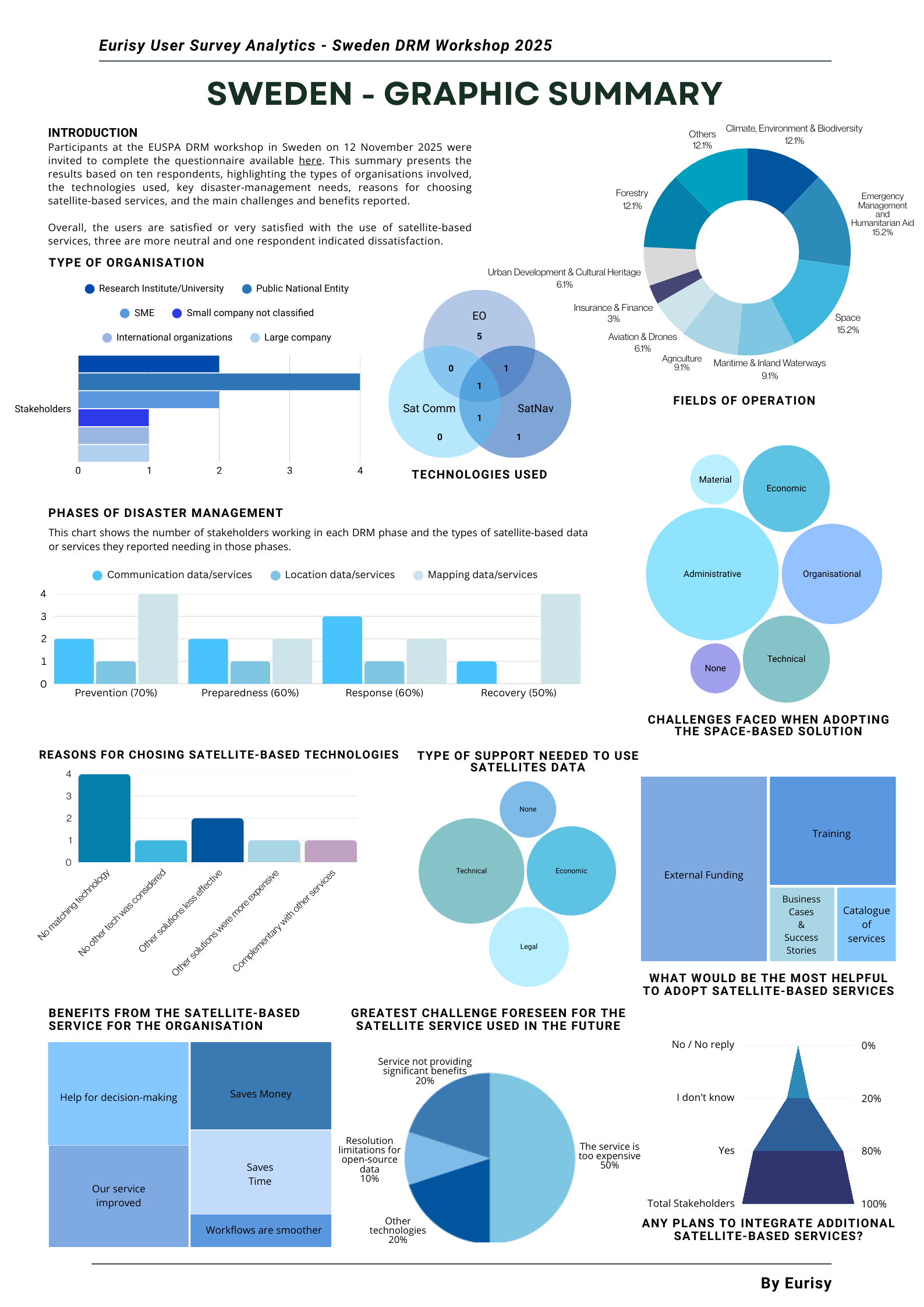
During the workshop, participants were also invited to complete a questionnaire available here on their uses of satellite-based services. You can find the results below: