Alsace Region, France: Protecting the European hamster from extinction
DREAL Alsace
Under the authority of the prefect of the region, the Alsace Regional Directorate for Environment, Planning and Housing (DREAL) is responsible for developing and implementing national policies in the areas of preservation of natural heritage and biodiversity, water management, construction, urban planning, housing, pollution and risk prevention, transport, climate and energy.
The challenge
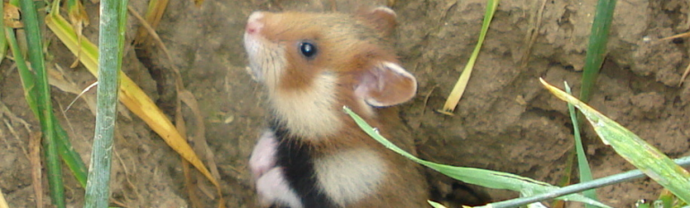
Alsace is the only region in France inhabited by the European -or common- hamster. Living in areas generally fertile and cultivated, the hamster has long been hunted, and it is now an endangered species (in 2003 the Commission even sent France a final warning for not taking adequate measures to protect the Alsatian Hamster).
Since DREAL is responsible for leading the national action plan for the hamster, which includes actions for improving the species’ habitat, it is essential for the Directorate to periodically evaluate the measures undertaken in this respect. The high cost of field surveys as a way to monitor habitat quality means that they cannot cover the hamster’s habitat entirely. Furthermore, the information on the type and surface of crops, provided by farmers in their annual statements under the framework of the EU Common Agricultural Policy, are only available in the fall, when the hamster’s hibernation period has already begun. This information is essential for detecting hotspots in the habitat but is not available early enough to act.
The satellite solution
Within the framework of the National Action Plan for the common hamster, DREAL contracted SERTIT -the Regional Service for Image Treatment and Remote Sensing of the University of Strasbourg- to get habitat maps derived from satellite data in spring. Such maps allow users to identify favourable crops and the main threats to the hamster, e.g. landscape fragmentation, expansion of bare soil areas and urban pressure on habitats. This enables DREAL to analyse the small rodents’ biotope and to plan measures to further protect this species.
The result
The integrated use of field surveys and satellite imagery to monitor the common hamster’s habitat is now a routine methodology listed in the current action plan for the species. The information thus obtained helps to better identify priority sites in which agricultural measures should be taken in the following year to improve the hamster’s habitat. As an example, farmers are advised to focus on wheat or alfalfa plantations providing food and protection to the hamster in spring and in early summer, or to leave some plots of land unharvested to provide hamsters with coverage against predators.
By sharing this information with all stakeholders, in particular with regional environmental protection associations, local communities and relevant professional associations, among others, can become more than mere observers by acting efficiently according to the needs of the species.
“The maps produced from satellite images allow for a quick and accurate assessment of the quality of the hamsters’ habitat around population centres. Complementary agricultural measures can thus be promptly implemented in critical sites identified”. Cécile Bouquier, Project Manager, DREAL Alsace