Archelon: Engaging the public in the protection of sea turtles thanks to satellite navigation
ARCHELON
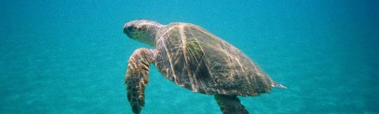
ARCHELON is an NGO working for the study and protection of sea turtles and their habitats in Greece. Its activities include monitoring of turtle populations, managing nesting beaches, rehabilitating injured turtles, and educating the public.
The challenge
Sea turtles are migratory species that may travel hundreds or thousands of kilometres across open sea between foraging and breeding areas. Learning about these migrations is important for a more thorough conservation of the animals across their territories, often involving several national jurisdictions. Information on foraging areas, where sea turtles spend most of their time, is sparse. Indeed the remoteness of these sites makes them more difficult to access than nesting areas, where monitoring tracks of emerged turtles is relatively easy. Finally, engaging with the public in attractive, innovative ways is crucial to raise awareness and to keep funding the tracking scheme.
“Contribute towards ensuring biodiversity through the conservation of natural habitats and of wild fauna and flora in the European territory of the Member States to which the Treaty applies”. Habitats Directive 92/43/EEC, art.2
The satellite solution
ARCHELON uses the Argos/CLS global satellite navigation system to locate and track the turtles which are equipped with transmitters. This solution helps track turtles over great distances, the data being automatically analysed to produce daily online maps. The Satellite Tracking Analysis Tool from www.seaturtle.org is then used to manage the data and to engage online with the public.
The satellite application is a result of an inter-governmental project between Greece and Italy, involving the Management Agencies of the protected areas of Amvrakikos Wetlands and Messologhi Lagoon, both Greek NATURA 2000 sites.
The result
The costs for physically tracking turtles in the open sea are much higher than for deploying a satellite tag, so for relatively little money ARCHELON can gain great insights into turtle behaviour. The use of satellite navigation also enables to reach a global audience. Anyone with an internet connection can check the projects’ web pages to see where the turtles are going. It is also possible to “adopt” one of these study turtles via a small fee, to support the continuation of the project.
ARCHELON intends to keep using satellite information to raise awareness on the turtles’ plight as well as for lobbying, scientific, and fundraising purposes.
“This is a great benefit for raising awareness among the public and authorities. When we tell and show local residents in Greece that the turtles they can see where they take their own morning swim have swum away to Italy, Tunisia or Syria they are invariably impressed.” Dimitris Margaritoulis and ALan Rees, ARCHELON Scientific Committee.
![]()