BlueDiscovery: Improved management of Marine Protected Areas
Blue Thread developed the Blue Discovery app to support the management of Marine Protected Areas.
Blue Thread
![]() Blue Thread S.r.l. is a small Italian company based in Rome and founded in 2019. The company’s mission is to develop technological solutions for the maritime and nautical world. By using a multi-technological approach that integrates different knowhows, the company aims at responding to the multiple challenges that the maritime domain faces, from improving navigation to monitoring the access to ports and remote marine areas.
Blue Thread S.r.l. is a small Italian company based in Rome and founded in 2019. The company’s mission is to develop technological solutions for the maritime and nautical world. By using a multi-technological approach that integrates different knowhows, the company aims at responding to the multiple challenges that the maritime domain faces, from improving navigation to monitoring the access to ports and remote marine areas.
Blue Thread collaborates with international and national research centres, such as the University of Tor Vergata in Rome and the Istituto Superiore Mario Boella in Turin. In addition, Blue Thread also developed a fleet monitoring application prototype for sailing races with a wide range of features, such as an optimised start strategy, a lay line determination, and a racecourse registration.
The challenge
According to the FAO’s definition, Marine Protected Areas (MPAs) are marine geographical areas that need greater protection than the surrounding waters for biodiversity conservation or fishery management purposes. In its geographic diversity, Italy counts around 29 MPAs across the country. Each of these areas is classified according to the protection needed, based on natural, geomorphological, physical, scientific, economic, and educational relevance.
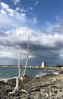
Monitoring and safeguarding MPAs is a complicated task for the local authorities responsible for these areas, due to their extension and to the financial resources required to protect their biodiversity. When it comes to MPAs that are touristic destinations, like the MPA in Porto Cesareo in the Apulia region, monitoring the flux of tourists, their activities, and behaviours, becomes quite challenging.
The satellite solution
In 2019, Blue Thread developed Blue Discovery, a GNSS-based mobile app free to download and available for IOS and Android. The app is![]() complemented by a web-GIS and an Operational Portal that could be managed by the MPA authorities. This was the case for the MPA of Porto Cesareo, that tested the app during the Summers of 2020 and 2021. Blue Discovery allows visitors to get information on the rules to access and visit the marine protected area, on the itineraries to follow, and on the spots of interest in the area surrounding the MPA. The app relies on GNSS technology embedded in smartphones and allows the authorities responsible for managing the MPA to have reliable information and increased position accuracy on the visitors of the areas through the Operational Portal.
complemented by a web-GIS and an Operational Portal that could be managed by the MPA authorities. This was the case for the MPA of Porto Cesareo, that tested the app during the Summers of 2020 and 2021. Blue Discovery allows visitors to get information on the rules to access and visit the marine protected area, on the itineraries to follow, and on the spots of interest in the area surrounding the MPA. The app relies on GNSS technology embedded in smartphones and allows the authorities responsible for managing the MPA to have reliable information and increased position accuracy on the visitors of the areas through the Operational Portal.
A crowdsourcing function of the app allows visitors to send to the area’s managing authority short reports on the sighting of protected species or on environmental crimes. Visitors can upload on the app geo-referenced photos of what they see with the time on which they took them, together with additional details to help the local authorities to intervene in real-time. Furthermore, Blue Discovery provides visitors with the opportunity to request, pay, and issue permits for activities to be carried out in the MPA directly on the app. All the data collected by the visitors are immediately visualised by the authority on the web portal, which becomes a database of events happening in the protected area that can be monitored by the authorities and used for reporting.
The results
The app allowed the authorities of the marine protected area of Porto Cesareo to monitor the flow of visitors and to keep track of their position in the area. The Blue Discovery app helped the authority of Porto Cesareo to optimise the time and resources deployed to patrol the area, and to validate the fares paid by the visitors and their permits.
Blue Discovery is constantly under development to better support the authorities in charge of managing marine natural areas. Today, Blue Thread is planning to include Earth observation imagery in the app, with the aim to provide additional support for navigation routes, thanks to the implementation of ad hoc ship detection maps. Lastly, Blue Thread is planning to include in the app the Galileo Commercial Authentication Service (CAS), that will provide authenticated, certified positioning, to avoid privacy and legal issues between the visitors and the MPA’s authorities.