Countryside Council for Wales: updating the habitat map using satellite imagery
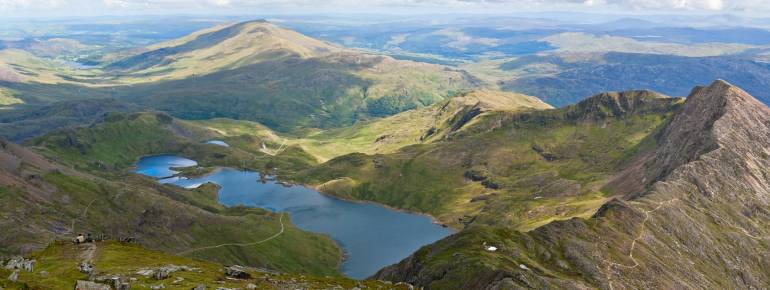
The region
The Countryside Council for Wales (CCW) is the advisory body in charge of ensuring the conservation and sustainable public access to the natural heritage of Wales. Protected areas represent 30% of its territory.
The challenge
The CCW needs to take informed decisions about managing natural heritage, as well as public access to it. Furthermore, every year it must report to the Welsh Government on whether or not the targets set by Ministers are met. In doing so, the CCW has relied on a map based on field surveys between 1979 and 1997, complemented by aerial photography.
As the landscape is subject to continual change, the CCW needs a means of acquiring spatially accurate, up-to-date information on landscape change and habitats. Since updating the habitat map by using traditional technologies and methods would have proved very costly, the CCW needed to devise a new methodology and identify other sources of information to perform the update.
The satellite solution
The existing field survey based habitat map served as a base reference for investigating the potential of using satellite imagery to improve the spatial accuracy of areas of vegetation and the assignment of habitat classes. The result, an improved and updated habitat map, can now serve as base reference for future updates using satellite imagery (potentially freely available through GMES) permitting automated habitat classification and change detection. The habitat map is integrated into the CCW’s internal geographic information system.
The decision to use remote sensing by satellite was facilitated by the assistance provided to the CCW by the British National Space Centre (BNSC – now UK Space Agency) in the framework of the GIFTSS programme (Government Information from the Space Sector), which supports the access of public authorities to satellite information and services.
The result
The updated habitat map has been produced at a fraction of the cost of the previous version, and future updates are expected to be even faster and more cost-efficient. The map allows for the very detailed visualisation of the country’s overall landscape, identification of the fragmentation of habitats and the spatial planning and mapping of potential ecosystem goods and services, such as carbon storage and biomass potential. CCW will use this information to draw up and implement long-term strategies for nature conservation and advising the Welsh government.
“Here in Wales we have proved how well satellite-based habitat mapping can work, and encourage other regions to learn from our experience.” Alan Brown, Remote Sensing Manager, Countryside Council for Wales.
Key fact: Sustainable, automatically repeatable and inexpensive method of updating
![]()