DSE: Copernicus to help insurance companies dealing with climate-related damage to agriculture
DSE-Data Science Experts
DSE-Data Science Experts is a company created in 2020 and focused on building products and solutions based on Artificial Intelligence (AI).
Based in Grenoble, France, the company today employs 11 people. The team’s vision is to help insurance companies to better support the agriculture sector in times of natural disasters.
The challenge
According to the World Meteorological Organization’s Atlas of Mortality and Economic Losses from Weather, Climate and Water Extremes, the number of disasters related to a weather, climate or water hazard has increased by a factor of five between 1970 and 2019 globally. Agrıculture is among the sectors that are affected the most by climate-related disasters.
To establish mechanisms, and in particular insurance schemes, to support the recovery of agricultural activities affected by disasters, there is a growing need for data and information to foresee and assess such damages.
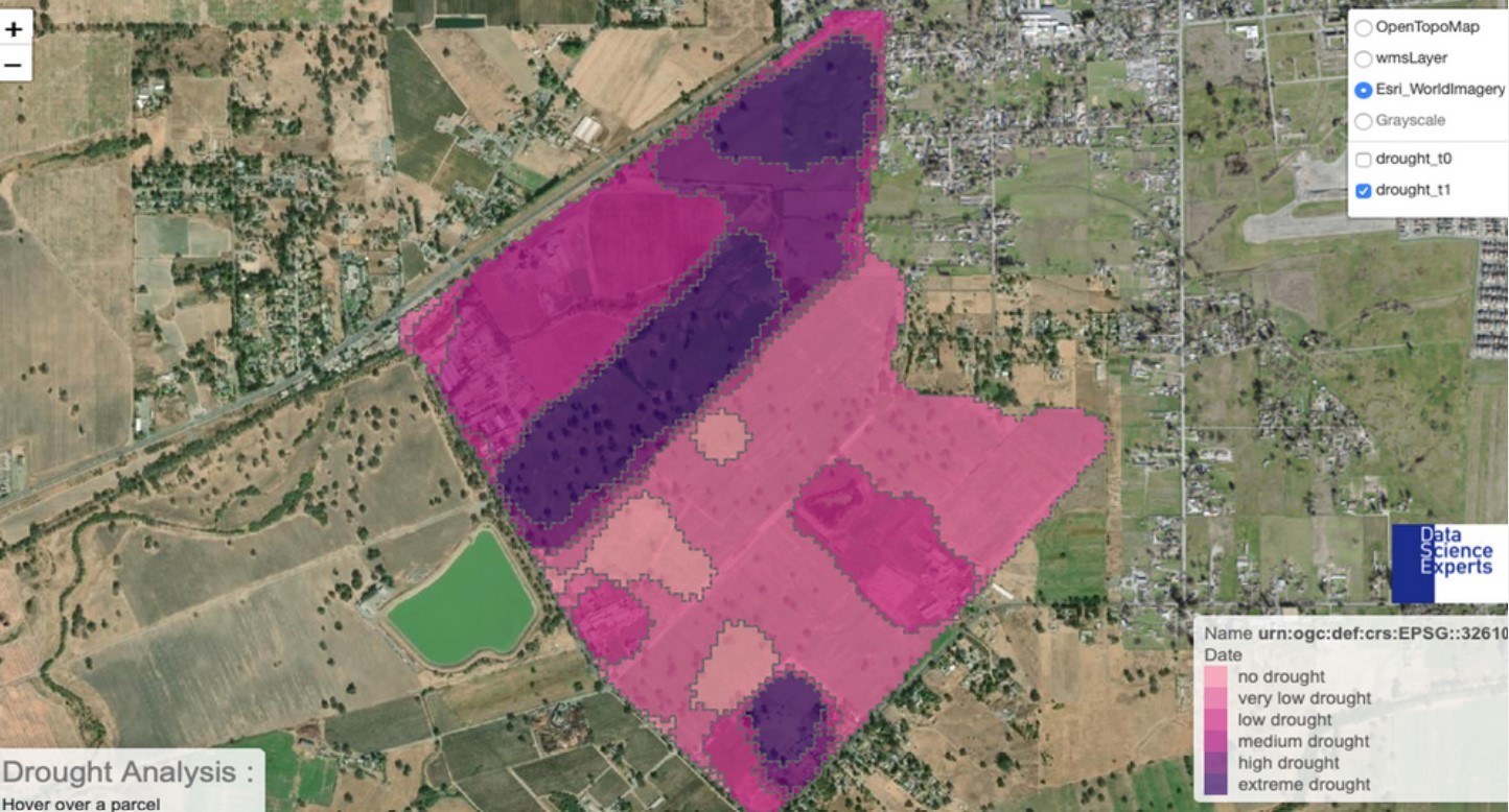
The satellite solution
AIperion is a system, developed by DSE, that estimates the damage affecting agricultural fields, identifies the boundaries of flooded and burned areas, and detects the extent, impact and duration of droughts based on extreme weather events or natural disasters.
The system is based on Artificial Intelligence (AI) applied to Earth observation images to identify and detect the boundaries of flooded and burned areas. It integrates meteorological data from the MSG mission (Meteosat Second Generation satellites) to detect the intensity and duration of extreme weather events.
AIPerion relies on data from the Copernicus Sentinel-1 and Sentinel-2 missions to calculate vegetation indices and estimate agricultural damage.
These analyses are combined to produce an assessment of the level of damage to the crops and of its causes. The results are provided to customers through a dashboard, in the form of maps and figures.
The results
By integrating Copernicus data into their software, DSE can provide precise information on the crops’ health and determine if the damage to crop reported by farmers is a consequence of natural disasters and not of fraud attempts.
Moreover, based on the information provided by DSE, insurance companies can determine the premium to be paid for crop losses caused by natural disasters.
Under the request of one insurance company, using this system DSE was able to map 80% of cultivated fields on the French territory to detect the growth status of vegetation. That was made possible thanks to the high temporal resolution of the Copernicus data and could not have been done by using in-situ surveying techniques.
Using free and open Copernicus data, DSE can provide its services at a much lower cost than the price that they would ask if they used other paying satellite data. As a result, after only one year of existence, the company can count some of the world’s biggest insurance companies among their customers.
In 2020, the AIPeiron system has been awarded the Copernicus Masters Prize for France.