East Belgium: Encouraging green tourism
The Region
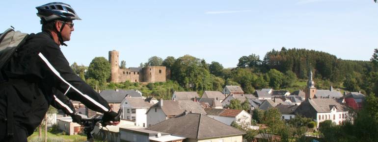
Bordering on the Netherlands, Germany and Luxembourg, East Belgium has a significant diversity of landscapes, from castles and farms in the north to the High Fens in the centre and lakes and valleys in the south. Such a diversified landscape attracts nature lovers for hiking, cycling, mountain biking, horse back riding and other outdoor activities. The East Belgium Tourist Office is the entity in charge of promoting tourism and assisting visitors in planning and enjoying their stay in the region.
The Challenge
The territory of East Belgium has a very interesting natural and historical heritage. The Tourist Office promotes green tourism in various ways and puts an emphasis on enhancing cycling and mountain biking as a means to discover the region’s beautiful landscapes. 850 km of cycling itineraries covering the whole region (“Velo-Tour”), and 450 km of mountain bike itineraries have been created, together with paper maps which enable visitors to discover the area autonomously. One cycle path in particular, the Vennbahn, covers 125 km on a former railway line crossing Germany, Belgium and Luxembourg and is especially appreciated by families and bike enthusiasts because of its low inclination of 2-3%.
As the demand for biking itineraries grew, the Tourist Office looked for a way to make a better use of the already existing infrastructure and to reach a greater number of potential visitors by creating online services.
The Satellite Solution
Since 2006, the Tourist Office created sections on its web portal dedicated to cyclists and mountain bikers wanting to discover the diversity of East Belgium in a more active and environmentally friendly way. The “Vélotourisme” section offers 18 thematic biking itineraries designed to meet the demand of cyclists with different levels of ability. Combining urban and rural road stretches, they show the length of the proposed cycling paths, their degree of difficulty, the nature of the road surface and circulation. Moreover, the website hosts a section especially dedicated to mountain bikers, which provides downloadable GPS tracks that can be visualised on Google Earth maps. The Tourist Office also offers a rental service of GPS devices for mountain bikers.
The Results
Since the creation of the downloadable interactive maps and GPS tracks, the Tourist Office can reach new users, who could previously consult the itineraries only on paper maps. The number of visits on the website of the Tourist Office has increased considerably, while the GPS tracks provided are downloaded thousands of times per year. The GPS rental service, applied for the moment to mountain bikes, should soon be used also for walks.
Capitalising on the VeloTour’s results, since 2014 the Tourist Office has developed an online route planner for hikers (www.go.eastbelgium.com) covering 900 kilometers which can be discovered using any mobile device incorporating satellite navigation.
“The positive evolution during the last few years encourages the Tourist Office to promote East Belgium as a TOP Cycling Destination in Europe by using new technologies”. Sandra De Taeye