Energy operator SIEA: ensuring the accuracy of newly built infrastructure
The company
SIEA (Syndicat Intercommunal d’énergie et de e-communication de l’Ain) is a public body created in1950 to manage energy, gas and IT infrastructure for the 419 municipalities of the French region of Ain. SIEA is run by a committee of 508 delegates elected by the town councils.
The challenge
SIEA is responsible for assessing building plans for the installation of electric, gas and IT cables in the region. Once the work is completed, SIEA also verifies the accuracy of the building works as per plans, and documents the position of the newly installed cables for future reference.
The syndicate was looking for an affordable, reliable and more precise check-up and mapping system to carry out these duties.
The satellite solution
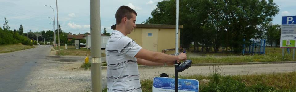
SIEA adopted a solution provided by Ashtech, a designer and developer of satnav technology, which enables SIEA staff to compare the position of the cables as recorded by themselves in several check-points, with the position of the cables as indicated by building contractors in their end-of-project reports. The GIS software that allows this precision check automatically labels cable positions as “accepted” or “rejected” according to whether they are actually located there. This results in the production of a highly accurate map of the cable infrastructure for the authority.
The application is possible thanks to a real-time connection of GPS receivers with TERIA, the French GNSS reference station network, which allows for a centimetre-accuracy of the final result.
The result
The satellite solution enables SIEA to verify simply and efficiently the as-built plans for new buried optic fibre, gas and electric lines with centimetre-level accuracy in real-time. Moreover, the geo-referenced information collected on the field improves the overall accuracy and reliability of the geographic information system used by the Syndicate to avoid risks and accidents in future works.
While enabling SIEA’s operators to save a considerable amount of time, these methods are expected to also increase building contractors’ performances in the coming years.
“This solution permits us to locate our lines with high precision, without having recourse to topographic maps which cannot be updated for an entire department on a regular basis.” Bruno Forget, GIS Responsible, SIEA.