Sustainable forest management in Sweden with the support of satellite imagery
The user
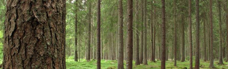
Seventy percent of the Swedish territory is covered by forests. 90,000 people are employed in the forestry sector, which generates an export value of €12 billion. The government and the industry own around half of the national forests, while the other half is owned by over 300,000 individuals.
The Swedish Forest Agency (SFA) is the public body in charge of ensuring the implementation of the Swedish Forestry Act, which aims to maintain production levels while protecting biodiversity.
The challenge
Under the Forestry Act, private forest owners are obliged to replant the forest land which has been cleared in the previous years. When forest owners plan to clear-cut an area of over 0.5 ha, they have the obligation to notify the SFA. They then have three years to proceed with the harvesting of the timber.
To make sure that legal obligations are respected and to detect illegal activities, the SFA needs continuous and accurate information on the state of the country’s forests.
The satellite solution
Since 2000, the SFA has included satellite imagery into a country-wide system integrating and sharing geographic administrative data. The use of satellite data was facilitated by the Enforma project. Kick-started in 1997, the project explored possible applications for satellite imagery coming from SPOT satellites. Once the system was implemented, SFA realised that nearly 10% of the clear-cut areas (around 25,000 hectares) were not cut in accordance with the notifications received from owners.
Satellite imagery, combined with other geographical information, allows the SFA to create clear-cut maps showing where forests have been cleared. The images are purchased by the SFA in co-operation with other governmental entities. The Agency then processes the images to highlight clear-cuts and makes the maps available on its website as open data. By using these maps, the SFA is able to check if the clearings were approved by law and take action where appropriate.
The results
Forest owners are now aware that the SFA can monitor their land, and thus law compliance has greatly improved. According to the SFA, the use of the imagery led to a fall in the size of forests area cleared illegally, which has fallen from around 10% of harvested forest each year (in 2003) to less than 0.5% in 2005.
Yearly, the SFA spends approximately €500,000 to purchase and use the imagery (including salaries), but its advantages are large. The SFA saves time to monitor the forests, while a more sustainable use of forest resources has lead to an increase of timber production. Wood quality has also improved. Positive externalities also include wild life preservation and forest diversity protection measures. In a recent report, the European Association of Remote Sensing Companies* estimates that the use of imagery brings Sweden between €16.1m and €21.6m per year in direct economic benefits.
By integrating satellite imagery into our tools, we can be more efficient in monitoring forests and working towards an economically and environmentally sustainable forestry: better regeneration, fewer illegal clear-cuts, and more attention to protected areas.”, Anders Persson, Swedish Forest Agency
*The information included in this article has been extracted from the EARSC report “Copernicus Sentinels’ Products Economic Value: A Case Study of Forest Management in Sweden”, January 2016.