Ireland: using satellite applications to boost farming
The user
Teagasc – the Agriculture and Food Development Authority – provides research, advisory and training services to the agriculture and food industries, as well as rural communities. Serving 40,000 Irish client farmers, the agency works closely with universities, government institutions and farmer associations to support innovation in the agri-food sector.
The challenge
The 2008 economic crisis meant Teagasc had to cut costs and close down many regional offices which had enabled it to offer a proximity service to farmers. To continue to assist farmers remotely, Teagasc needed to be able to locate them. However, Ireland lacked an address and postal code system, so it was impossible for Teagasc to have an overview of its customers.
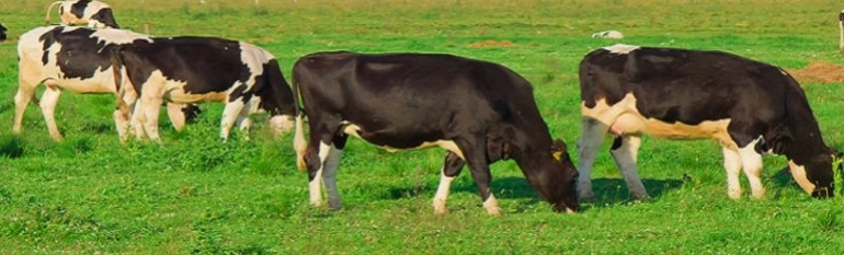
Furthermore, the 2013 fodder crisis cost the economy €900 million, putting a lot of farmers under extreme financial pressure. A new crisis could trigger serious animal health concerns and damage farm profitability. Since most of Ireland’s farming revenues come from dairy and beef products, it became urgent to better assist farmers with accurate information about grass availability, herd and stored feed demand. Finally, Ireland’s high 2020 targets for agricultural growth made using innovative ways of assisting farmers a national priority.
The satellite solution
In the absence of a functional postal codes system, Teagasc turned to using hand-held GPS devices to locate and identify their clients.
Furthermore, in the spring of 2015, Teagasc in cooperation with University College Cork launched an online platform based on satellite information from Modis satellite data. Continuous daily satellite data is used to give insights on biomass levels, vegetation growth and health. By combining satellite with in-situ measurements, Teagasc produced an interactive map based on weekly time series. Having a client friendly format, the map will allow farmers to stay up to date with grass growth forecasts each spring.
The results
Teagasc maintains a similar level of service as prior to closing down regional office. Thanks to regular updates, Teagasc advisors can understand local growing conditions around the country. Farmers can take better informed decisions on, for example, when to turn out cattle from winter housing. This can also help farmers plan their future storage and business activities.
The service is available during spring months. In the future it will include an early warning system to deal with fodder crises. It will also be made available to farmers directly thanks to smartphone and web-apps. Research is continuing to develop a high resolution grass growth forecasting system.