Lake Garda Community: monitoring water quality with remote sensing
The organisation
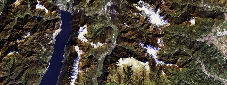
Lake Garda is the largest fresh-water basin in Italy and an important tourist destination. The Lake Garda Community is an interregional body representing 70 municipalities in the three regions neighbouring the lake: Lombardy, Veneto and Trentino-Alto Adige. It is in charge of coordinating the sustainable development of the Lake’s territory for land use, environment, water quality, safety, transport and road system, tourism, culture, agriculture and inland navigation.
The challenge
Habitat fragmentation, urban sprawl, tourist activities and air and water pollution are stressing lake ecosystems everywhere in Europe. Since the Lake Garda is a major tourist destination and its water is used in agriculture and as drinking water, it is fundamental to monitor its quality and temperature. Specific investigations are focusing on the qualitative and quantitative distribution of vegetation and on the proliferation of cyanobacteria, which seem to thrive in warmer water temperatures and that produce toxins that can cause adverse effects on human and animal health. Because of such potential risks on health and economy, the Lake Garda Community has a particular interest in evaluating the local consequences of a future increase in global temperatures.
The satellite solution
Since 2010, the Lake Garda Community is part of EULAKES (European Lakes Under Environmental Stressors). The European-funded project aims at enabling territorial administrators to prevent and manage the impact of climate change with the support of modern technologies. Within the framework of the project, satellite imagery is used to reveal water’s qualitative characteristics varying according to the temperature, as water clarity, algal biomass and class composition. For Lake Garda, the various species of macrophytes (aquatic plants particularly sensible to pollution) have been mapped and classified according to their sensibility. Macrophytes are especially important to evaluate the effects of pollution on aquatic ecosystems, since the most sensible species tend to diminish when pollution increases, and their quantity indicates whether or not the water is suitable for human and agriculture consumption.
The result
The maps of water characteristics produced on the basis of satellite imagery are already available to the authorities in charge of environmental protection in the territories neighbouring Lake Garda.
Satellite information allows authorities to monitor the effects of changing temperatures on the lake’s ecosystem and to assess the level of pollutants and the potential risks for the environment, people and businesses. Compared to traditional methods, satellite imagery allows to sample large areas simultaneously and cost-efficiently, more frequently. Authorities can appreciate changes locally and in time, since images of the same areas can be produced every few days.
“Remote sensing provides information that can be used to simultaneously coordinate environmental protection activities of all the territorial authorities of the Lake Garda Community.”