Mendrisiotto and Basso Ceresio: an innovative use of geolocation to promote ecotourism
The region
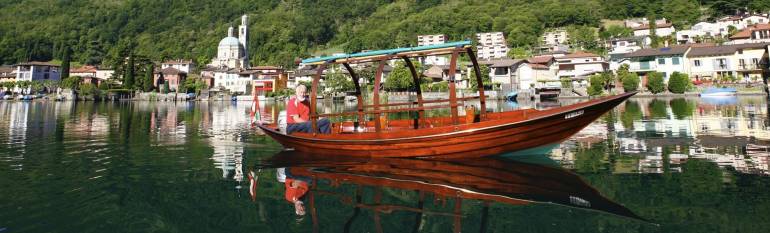
The Swiss region of Mendrisiotto and Basso Ceresio is located in the Canton Ticino, extending from the shore of Lake Lugano to the Italian-Swiss border. It is the southernmost and most densely populated region of the Swiss Confederation, with a strong service sector and a number of industries. 60% of the region is covered by forests, including areas of outstanding natural beauty, as the Parco della Breggia and the UNESCO World Heritage site of Monte San Giorgio, where fossils were discovered that can account for the geological history of the area over the last 240 million years. In addition, the region hosts some endangered habitats and species, included in the Emerald list of protected areas – a list established by the Council of Europe within the framework of the Bern Convention.
The challenge
Despite the beauty of the area, the region of Mendrisiotto and Basso Ceresio remains relatively unknown to tourists passing through it on the important routes connecting the North of the country to Italy.
The Tourist Board is responsible for maintaining a network of trails over a range of about 300 km. Some of these itineraries, which can be followed on foot or by bicycle, are marked by signs scattered throughout the landscape, which provide information on the geological and biological heritage of the region. In 2005, the Tourist Board decided to consider integrating or replacing the signposts, which were seen to disturb the harmony of the landscape and can be difficult to spot in wild areas. In addition, the Board sought ways to give greater visibility to the touristic paths.
Finally, the Board’s marketing strategy for promoting the didactical paths had to be compatible with the provisions of the Habitats Directive 1992, concerning the implementation of economic development plans in respect of natural heritage preservation measures.
The satellite solution
The Board decided to map thematic tourist itineraries using satellite navigation. Points of interest and the information associated with them were geo-located on Google Earth, Swiss Map and on the websites Tracemyworld.com and Gps-tracks.com. Furthermore, to make the information less “static” and more accessible when visiting the territory, the Tourist Board allows visitors to download for free the GPS tracks of the itineraries directly on their phones or mobile devices in Italian, German, French and English. The mobile app indicates the length, the height and the difficulty of each itinerary, including multimedia contents such as images and video.
Some of the itineraries have been designed in collaboration with other tourist offices, or other environmental organisations. The collaboration with the WWF, for example, led to the creation of nine geolocated itineraries to discover the flora and the fauna of the “Emerald” zones in the territory. Another interesting initiative, “Road to Wellness”, has instead led to the development of e-bike itineraries also involving local hotels renting electric bikes. Other tracks guide tourists through the local vineyards and cheese factories, thus permitting to enjoy not only the landscape, but also local products.
The result
The GPS tracks of the thematic itineraries allow visitors to discover the territory autonomously. The collaboration with websites such as GPS-Tracks and Tracemyworld and other entities engaged in environmental protection, such as the WWF, in addition to the involvement in initiatives such as “Road to Wellness”, enabled the Tourist Office not only to develop the contents of the thematic itineraries, but also to make their existence known to a wider audience.
The GPS tracks of the thematic itineraries enable us to promote sustainable tourism in the region while providing visitors with innovative, modern tools to be guided at the discovery of the territoryNadia Fontana Lupi, Tourist Board of Mendrisiotto and Basso Ceresio.