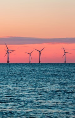
North Sea: Planning offshore wind energy in the Digital Twin of the Sea
The Dutch Ministry of Infrastructure and Water Management uses a platform based on in-situ and Earth Observation data to plan offshore windfarms in the North Sea basin.
The Dutch Ministry of Infrastructure and Water Management
 The Dutch Ministry of Infrastructure and Water Management is committed to improving quality of life, access and mobility in a clean, safe and sustainable environment. The Ministry strives to create an efficient network of roads, railways, waterways, and airways, and to implement effective practices to better manage floods and improve air and water quality.
The challenge
The Maritime Spatial Planning Directive requires EU Member States to draw and apply maritime spatial plans. The Ministry of Infrastructure and Water Management is the coordinating ministry for the integrated North Sea policy and manages the Dutch part of the North Sea. High on its agenda there is the construction of new offshore windfarms. However, the North Sea basin is under a lot of pressure and finding suitable locations is not an easy task.
Transforming governmental ambitions of sustainable use of the sea into something concrete means fitting all the needs in one coherent spatial plan, which implies trade-offs. The situation can become very complex when all the different stakeholders and interests are considered (e.g., marine protection, aquaculture, shipping lanes, recreational activities, existing telecom, energy corridors, etc.). Other pieces of the puzzle, such as the capacity of the electricity grid, the infrastructure required to get the energy from the windfarm on the national grid, and boundary conditions, are also crucial to meet the national ambitions for offshore windfarm development.
The satellite solution
The Breda University of Applied Sciences is a government-funded higher education institute in the Netherlands. Under the Academy for Games and Media, the University has a research programme concerning serious games and complex decision-making. One of its projects is a Maritime Spatial Planning simulation platform relying on game technology and design, meant for those who must spatially plan the sea. Since a few years, the MSP Challenge Simulation Platform is used within the Digital Twin North Sea project, a cooperation between government agencies, knowledge institutes and the business community to create a state-of-the-art support tool for policy makers, stakeholders, scientists, and citizens.
This ‘digital replica’ of the North Sea simulates spatial plans and their effects. The current Digital Twin North Sea consists of three components: a browser version, the MSP Challenge simulation platform, and a virtual reality prototype module. The tool offers a map of the North Sea basin to simulate the energy production and the infrastructure needed to get the maximum capacity from wind farms installed there to the national grid. Multiple layers are available, such as wind speed, wave height, bathymetry, and sediments. The map also displays the location of current offshore windfarms and shows where new windfarms are being considered for development. One important contributor to the tool is the Copernicus programme, which provides free and open marine data that are integrated in the different layers, and that consists of satellite images, models and data visualisations.
The results
The MSP Challenge Simulation Platform provides, on a free and open-source basis, an engaging tool for students, professionals and policy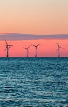 makers to better understand basic electrical engineering in offshore wind power development and the spatial implications of it. The Dutch Government has been continuously investing in the development and application of novel simulation and game technologies since the international conference on Maritime Spatial Planning held in Lisbon in 2011. The current simulation platform is the result of a fourth design iteration.
Because the MSP Challenge makes use of GIS data, the platform provides direct feedback while testing out different scenarios. Thanks to the platform, policy makers can now engage stakeholders in a pragmatic way. The multi-user system allows to create shared servers to work in a co-creative setting with multiple stakeholders at a time, both during live and online sessions. In addition to the North Sea, the platform also covers the Baltic Sea, the Clyde Marine Region, and the Adriatic Sea.