The SCAEL cooperative: sparing fertilisers thanks to satellite information
The SCAEL group
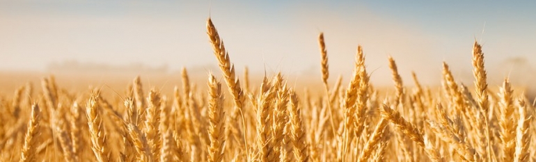
The SCAEL group is an association of 1 700 farmers, created in 1886. Its members are associates as well as clients to the group for their supplies (seeds, fertilisers). Moreover, the association supports its members in selling crops nationally and internationally. The cooperative produces mainly wheat (358 000t/year), rapeseed (90 000t/year), barley (87 000t/year), corn (85 000t/year) and durum wheat (74 000t/year).
Other activities include the production of seeds, laboratory studies and benchmarking new technologies of interest to members.
The challenge
Nitrite pollution affecting both water and crop quality for exports has been an issue of concern for many years. As early as 1992 the cooperative used an advice service which produced nitrogen nutrition indicators based on an analysis of samples of the juice in the plants’ stem. However, sampling in the field four times a year over an area of 8 000 hectares was complicated in terms of logistics. The service was also only available for wheat crops.
“With the aim of providing for all waters a general level of protection against pollution, Member States shall (…) establish codes of good agricultural practice, to be implemented by farmers on a voluntary basis, which should (…) (reduce) pollution by nitrates (…) in so far as they are relevant (to) periods when the land application of fertilizer is inappropriate”. Nitrates Directive 91/676/EEC
The satellite solution
Since 2004, the SCAEL cooperative started using Farmstar – a precision agriculture advice service developed by Astrium, a satellite data provider, and Arvalis – Institut du végétal, a research institute on applied agriculture. Farmstar combines both satellite and in-the-field information collected by SCAEL’s technicians to advice farmers on the quantity of fertilisers to use, according to the real needs of crops, so as to avoid excesses. It also gives lodging and likelihood of crop disease. Subscribing farmers receive a map with advice by email, at a cost ranging from €6.5/ha to €10/ha, depending on the area covered. They can load this map on their GPS-guided machinery for optimal distribution of fertilisers or growth regulators.
The result
Service adoption has increased continuously, especially among young farmers, since its introduction in 2004. Today 525 farmers have subscribed to the service, covering an area of about 30 000 hectares. In addition to improving product quality, the service allows farmers to prepare for what the cooperative anticipates to be ever more demanding regulations on water pollution in the near future.
In the coming years, the cooperative aims at extending the advice service to cover other crops as well to be able to identify rapeseed diseases, weeds coverage and soil sulphur content.
“It is a useful service for us, especially in view of increasingly demanding regulations on water pollution. Among our lessons learnt from this experience: as a cooperative, you can’t let the tool live by itself. Running it successfully requires skilled professionals to manage the service, regular information meetings with the farmers, as well as yearly quality controls.” Mathilde Lejards, SCAEL Group