The Western Slovakia Water Company uses GNSS to map water infrastructure with centimetre accuracy
The Western Slovakia Water Company
Západoslovenská vodárenská spoločnosť a.s. (ZsVS) is a joint-stock company funded in 2002. It operates in an area in West Slovakia including 11 districts, 507 municipalities, and 950 000 inhabitants. Through seven regional offices, ZsVS is responsible for ensuring water supply for urban, industrial and agriculture needs, building and maintaining water mains, treating sewage waters and for protecting water sources in the area.
The challenge
In managing water infrastructure, ZsVS needs to know the position of water pipes as well as other infrastructure (gas pipes, fibre) with centimetre accuracy. Traditionally, the company’s surveyors mapped this infrastructure by distance measurements on the field and filling in paperwork. Then, once back in the office, they had to document their observations. This was both costly and time consuming, and left room for errors when filling in the data.
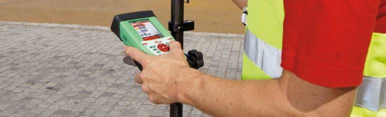
The satellite solution
Since 2008, ZsVS benefits from SmartNet, a network of permanent GNSS receivers, which improves the accuracy of GPS positioning compared to what is available to the general public. ZsVS surveyors now go on field to map the infrastructure equipped with mobile devices which capture a GNSS-improved positioning signal. Using a field computer linked to headquarter systems, surveyors send this information on location, condition, material and state of the infrastructure directly to the office in near real time. These maps are also made available to maintenance workers, allowing them to quickly find objects or damages in the field, or to perform underground works without threats to existing infrastructure.
The result
The Water Company is able to map water infrastructure much more precisely than it was previously possible saving time on paperwork and limiting errors. The improved maps enable maintenance workers to avoid damaging existing infrastructure when intervening on buried infrastructure. Finally, the company provides a more competitive and reliable service to its clients.
“The use of satnav in combination with SmartNet to collect field data makes ZsVS a more competitive company, since it enables savings both in terms of time and money, while enhancing the quality of our services.” Alexander Budai, Western Slovakia Water Company