Eurisy Members’ Corner: Empowering public administration in Poland with satellite data solutions
Ms. Jolanta Orlińska presented selected Polish activities fostering public administration in using satellite data solutions. Poland has a long tradition in space activities, but only joining the European Space Agency (ESA) contributed to a dynamic development of the Space Sector. In 2022 the ESA STAR portal counted for 450 polish space entities, involved in 540 projects and overall elaborating more than 100 new technologies. The role of the Polish Space Agency is to support the space industry and research organisations in building its technological competencies and business position and to encourage and support central and local government administration to use space science, technologies and applications to deliver better services to the citizens.
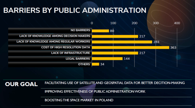
Polish administration points to several barriers that make the use of satellite data difficult for them: the cost of high-resolution commercial data, lack of knowledge and talents, lack of availability of products and infrastructure. POLSA has been working to eliminate these barriers and foster the uptake of Earth Observation data in a comprehensive way by building users’ awareness, creating infrastructure and the tools providing satellite data, products and services and analysing the law to ensure no legal obstacles could prevent polish public administrations from making the best and easier use of satellite data.
To tear down those barriers and to smooth the integration of satellite data POLSA created and runs the National Satellite Information System for public administration furnished with numerous Earth Observations products and services delivered according to the administration needs.
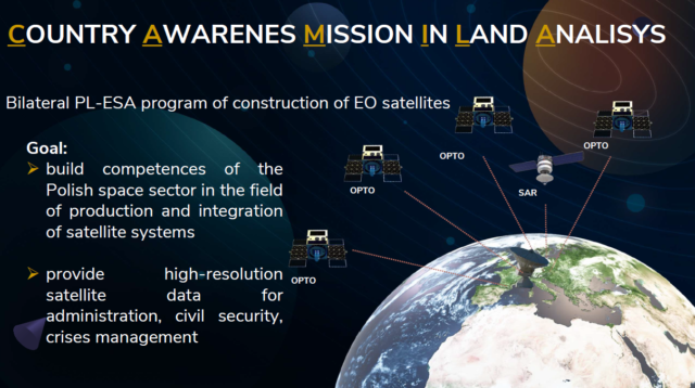
To close the gap POLSA is at the forefront to foster capacity building within the country and to integrate more and more national data. The project CAMILA (Country awareness mission in land analysis) designed for civil use will consist of at least three EO small optical and one SAR satellites. CAMILA will be created in the frame of bilateral programme of the Ministry of Technology and ESA with the goal to build the competences of Polish Space Sector in the field of production and integration of satellite systems and to provide high-resolution satellite data for administration, civil security and crisis management. Due to the growing number of hazardous situations related to climate change, promoting crisis awareness and management become crucial. Poland has an extensive experience and willingness to play a significant role in the development of civil security solution based on the satellite data. Moreover, the civil security from space is poised to be a Polish specialisation. In particular, experience of Government Centre for Security in building and exploring the geospatial system GISBN National Security in context of meeting needs of crisis management system, as well as CAMILA project, can contribute to creation of civil security hub in Poland. More details about the project are available here.
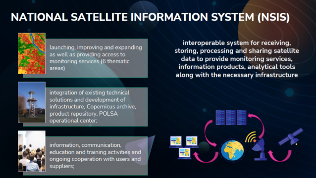
Ms. Monika Mierczyk-Burke, Senior Specialist, Earth Observation Department, gave an overview of the NSIS which is designed to increase the user uptake of satellite imagery and satellite products. The premise of NSIS is to create a national interoperable system which works with other national data platforms for receiving, storing, processing and also sharing satellite information products. The main three components of the platform are: Geoportal (web application enabling download and sharing the satellite products), marketplace (provides access to products, services and applications) and knowledge base (contains collection of information about satellite data). For the time being POLSA has prepared 8 satellite products: land cover maps, change detection maps, ortophoto and CIR ortophoto maps, SWIR orthophoto, urban heat islands, agriculture droughts and soil moisture. A live demonstration of the components and uses of the NSIS platform was made during the presentation, which covered such spheres of interest as land analysis, forestry, agriculture, crisis management, water management and environment. It has been visually demonstrated how to navigate among the many datasets and how to immediately draw intelligence from data. More information is contained in the presentation under this link.
Ms. Beata Janowczyk, Deputy Director of the Government Center of Security, presented a GIS system that was created in the beginning of the pandemic as a tool to provide information to society and also to build situation awareness in the context of pandemic. The system was developed further to cover additional domains. Firstly, to respond to the current demand on information needed to make decisions at various level of crisis management. For example, the system provides information on the Ukrainian conflict, like the situational analysis of displaced people, evacuated from Ukraine, current humanitarian situation in the country and more. Secondly, the system provides ongoing publication and monitoring of selected national entities, listed in the national documents which report on threats to national security. Thirdly, the system is used to inform the public about the current development of threats and activities created to counteract them.
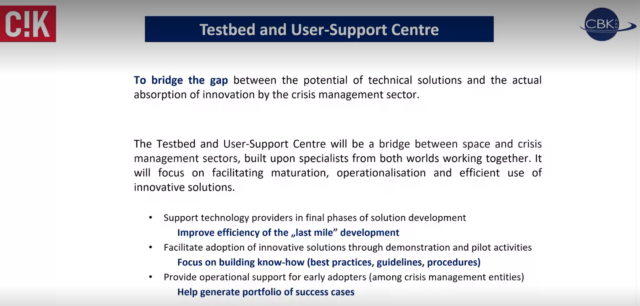
Mr. Jakub Ryzenko, Head of the Crisis Information Centre of Space Research Centre (Polish Academy of Sciences), elaborated on the current use of satellite data for civil protection. “The technologies are ready, but the people, the organisations and the structures are yet not ready to use space data”, he emphasized. During a massive wildfire occurred in Biebrza National Park in Poland, combining images from drones and satellite gave a trustworthy information for rescue operations. As argued by Mr. Ryzenko, in the view of the lack of know-how solutions, the Centre of Space Research suggested to establish a Testbed and User-Support Center to bridge the gap between the space and crisis management sectors, build upon specialists from both worlds working together, focusing on facilitating operationalisation of innovation, as well as supporting the ‘last mile’ of development of satellite solutions, to provide their reality check, verification and validation of solutions. This initiative would also facilitate adoption of innovative solutions through demonstration and pilot activities and provide operational support for early adopters.
During Q&A session the participants and attendees were provided with the floor to better understand how they could further explore the presented opportunities offered by the Polish Space Agency.
The video recording of the webinar is available under this link.