Epirus Region: How satellite imagery helped in identifying the risk of coastal water eutrophication
The Water Directorate of the Decentralized Administration of Epirus and Western Macedonia
The Directorate is the responsible authority for the protection and management of water resources in the region. It operates under the Decentralized Administration of Epirus and Western Macedonia. The area consists of about 8 Regional Units and 30 Municipalities. The authority has been created in 2011 as part of the Kallikratis Reform.
The Challenge
Monitoring the marine and coastal environment, and in particular, the water quality in coastal areas is crucial to identify potential threats and consequences on the economic activities developed along the European coasts. To harmonise and facilitate the monitoring across Europe, the EU laid the foundation for the definition of a legal framework on the water management and protection, safeguard and management of marine resources, including the Marine Strategy Framework Directive [1] and the EU Water Framework Directive [2]. The two Directives are transposed in the Greek legislation recognising the criteria defined by the EU as the main reference to ensure the correct management of coastal waters across the country.
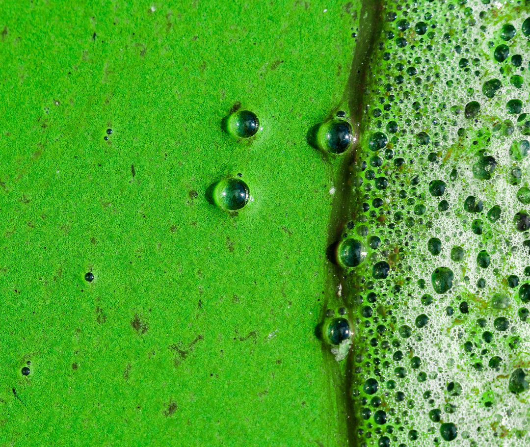 The Water Directorate of Epirus and Western Macedonia is tasked to monitor coastal water phenomena like eutrophication. “Eutrophication is an enrichment of water by nutrient salts that causes structural changes to the ecosystem such as increased production of algae and aquatic plants, depletion of fish species, general deterioration of water quality and other effects that reduce and preclude use“. [3] This anomaly heavily impact the water ecosystem’s health and biodiversity while affecting consequently related economic activities.
The province of Thesprotia, the most North-Western part of Epirus, has an economy relying mostly on fishing and tourism. The Epirus aquaculture sector represents 15% of the Greek export. In this context, unruly eutrophication could represent a damaging threat, for this reason, coastal waters in the area require constant monitoring.
A set of parameters to measure the eutrophication have been defined, such as chlorophyll concentration, water temperature and turbidity. Traditionally, the techniques adopted to monitor water health include the collection of in situ data and samples. These solutions are often not cost-effective, time-consuming, and they usually lack in reliability and completeness.
Satellite Solution
In recent years, the traditional methods to monitor water quality have been upgraded integrating Copernicus satellite data and available through the dedicated marine service, Copernicus Marine Service (CMEMS).
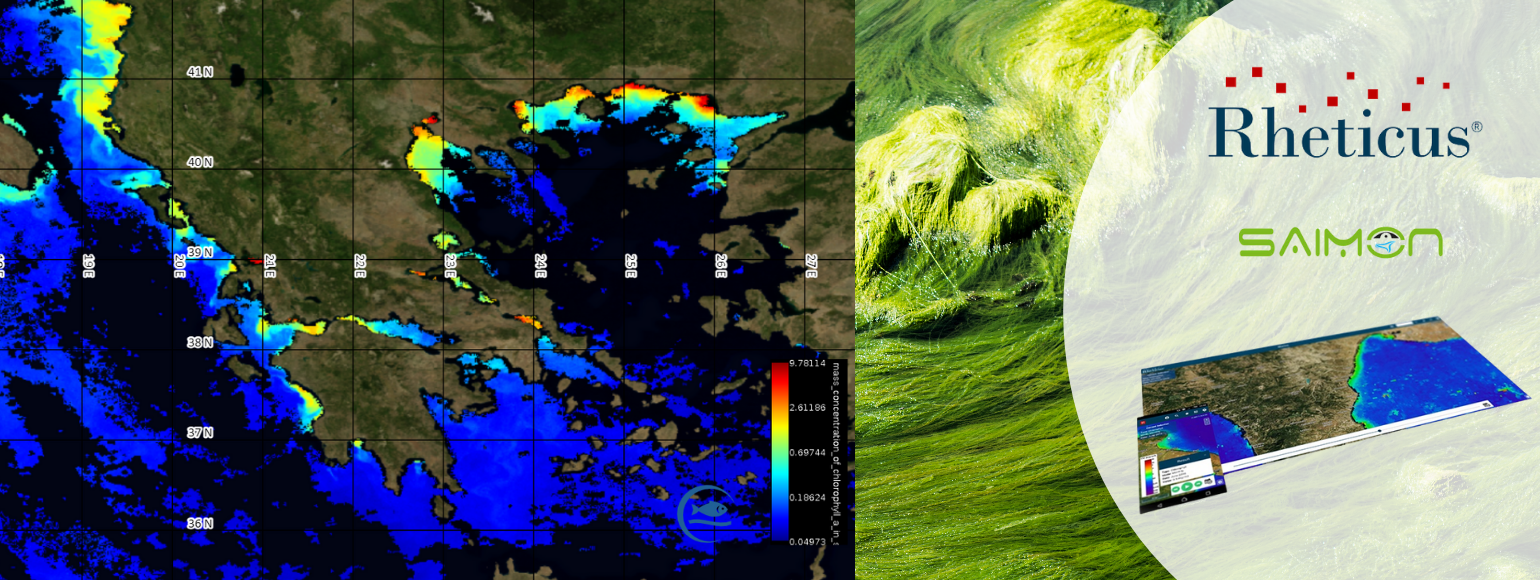
In the case of the region of Thesprotia, the set-up of a satellite-based service was necessary to meet the needs of the final users – aquafarmers, researchers, and citizens – to ensure the continuous monitoring of a vast area, reduce costs and provide reliable data. The result was a cloud-based geoinformation service, SAIMON (SAtellIte Near Real-Time MOnitoring Network of the Eutrophication Risk), included into Rheticus platform, developed by Planetek.
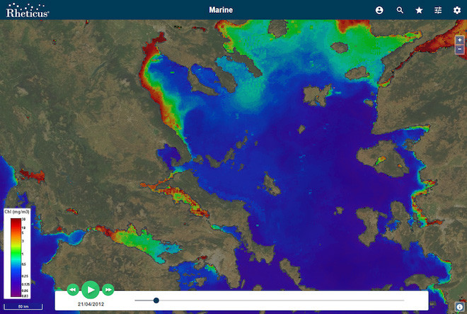 SAIMON is a Near Real-Time satellite-based monitoring network for coastal waters in Epirus and, specifically, for the province of Thesprotia. Planetek Hellas engaged into a series of discussions with the representatives of the Water Directorate and the Decentralized Administration, to customise the solution to better respond to specific needs.
SAIMON was developed in the framework of the IPA CBC Programme “Greece-Albania 2014-2020” approved by the European Commission, whose objective is to favour the cooperation between the two countries to capitalise on the advantages of the cross-border region.
The service relies on the Sentinel-3 constellation. The service automatically downloads the images captured by the satellites when a new image of the coastal area of the province of Thesprotia becomes available, and then processes them to extract and calculate relevant parameters.
The Results
The service helped Greek authorities to be compliant with the European Union directives on Waters and Marine Environment management and protection while fostering international cooperation between Greece and Albania
Through the use of SAIMON, the Epirus Water Administration provided aquafarmers, research centres, and citizens with reliable data concerning the quality of the water in coastal areas, making this data easily and widely accessible to the end users and public authorities. SAIMON, as well as the main reference platform Rheticus, represent innovative tools to address the need for detailed and up-to-date information on the production levels of mussels and other crustaceans.
[1] Directive 2008/56/EC of the European Parliament and of the Council of 17 June 2008 establishing a framework for community action in the field of marine environmental policy. https://eur-lex.europa.eu/LexUriServ/LexUriServ.do?uri=OJ:L:2008:164:0019:0040:EN:PDF
[2] Directive 2000/60/EC of the European Parliament and of the Council of 23 October 2000 establishing a framework for Community action in the field of water policy. https://eur-lex.europa.eu/legal-content/EN/TXT/?uri=CELEX:02000L0060-20141120
[3] Eutrophication definition by the European Commission: https://ec.europa.eu/environment/marine/good-environmental-status/descriptor-5/index_en.htm#:~:text=Eutrophication%20is%20a%20process%20driven,organisms%3B%20and%20water%20quality%20degradation.