Eurisy Members’ Corner: Focus on the Malta Council for Science and Technology
Supporting research funding for downstream applications, 16 September 2022
Focusing on concrete needs and empowering local administrations are the foundational elements of the strategy of the Malta Council for Science and Technology to develop a competitive space sector.
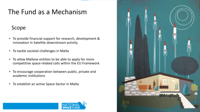
Dr Michael Quinton, working on Space Engagement & Programmes at the MCST, opened this new episode of the Eurisy Members’ Corner series by introducing the Malta Space Research Fund, created with the support of the European Space Agency in 2018. Malta is not yet a PECS (Plan for European Cooperating States) member of the European Space Agency, but conversations are ongoing to join the Plan, possibly by 2024. In the meanwhile, the country cooperates with ESA though mechanisms such as the Space Research Fund.
The Fund aims at providing economic and technical support for the development of space-based services that tackle societal challenges and encourages cooperation between public, private and academic institutions.
In 2018, the strong Maltese ICT sector was identified as the basis to build upon to develop a space sector in the country and since then 14 space-based services have been financed through the Space Research Fund. These serve as a knowledge base and are meant to encourage more research and investments into the downstream space sector.
Not only the Fund provides financial support, but also offers training to Maltese entities interested in exploiting the potential of Earth observation to apply for European funding.
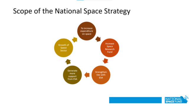
The ambition of the Space Research Fund is to serve as a catalyst: more research in the use of EO favours the growth of the sector, which encourages the government to invest more and to make more funds available. This results in an increasing number of local entities becoming interested in EO, and in more support being provided by ESA to sustain this virtuous cycle.
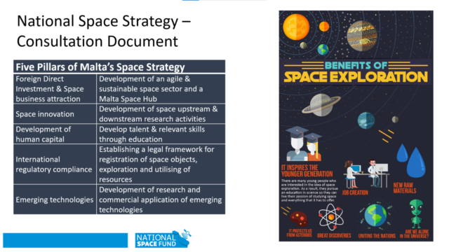
In January 2022, the MCST drafted a National Space Strategy based on five pillars: attracting foreign and direct investors that will allow local companies, also not involved in the space sector, to approach this market; boosting the development of innovative uses of EO; implementing trainings for local administrations and local people; developing a legal framework for space activities; and eventually favouring the commercialisation of the space-based products and services developed in Malta.
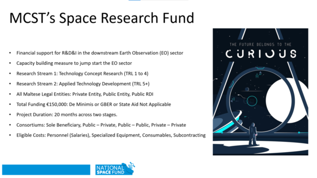
Projects can be funded up to 150.000 euros with a duration of 20 months. At the end of the first stage of 12 months, a technical and financial reports are evaluated by experts. The second stage of eight months includes local dissemination of deliverables and the showcase of the results of the projects.
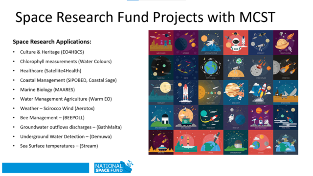
Since 2018, 14 projects have been selected through the Space Research Fund. These are related to diverse topics, all relevant to the Maltese economy, environment and society.
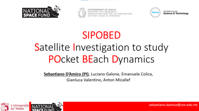
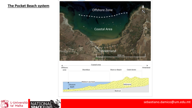
Among such projects, SIPOBED “Satellite Investigation to study POcket BEach Dynamics”, uses EO to study the dynamics of pocket beaches, i.e. small beaches that are isolated between two headlands.
The project, presented by Sebastiano D’Amico from the University of Malta, looks at the overall beach dynamics, both underwater and inland.
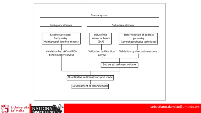
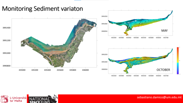
Malta is characterised by rocky and sandy beaches. In this project, satellite imagery is used to study the bathymetry (i.e. to measure the depth of the water) of sandy beaches, while drones and other techniques are used to validate the information provided by satellites. The goal of such project is to measure the volume of the sediments, to define a sediment transport model, and to eventually design planning tools to be used by coastal managers.
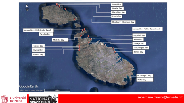
The system will be used on all pocket beaches in Malta, allowing for the monitoring of sediment transportation with centimetre accuracy. Furthermore, it will enable scientists to also spot other geological features that could influence the stability of the coast, such as soil displacements and earthquakes.
The project, that started over a year ago now, will provide Maltese authorities with information that they can use to proactively protect pocket beaches against coastal erosion.
Indeed, during the second year, the project will implement trainings for the coastal authorities to get acquainted with the GIS (Geographic Information System) produced, and will present a preliminary coastal erosion management plan to public authorities and other stakeholders.
Mr D’Amico also presented the Coastal SAGE project “Coastal Satellite-Assisted Governance (tools, techniques, models) for Erosion”, implemented in collaboration with the Ministry of Transport, Infrastructure and Capital projects of Malta.
This project focuses on coastal erosion on rocky beaches. EO is used in combination with Artificial Intelligence to monitor with millimetric precision ground motion that could cause rocks to fall near the beaches. The final goal of the project is to deliver to coastal authorities the information they need to prevent damage to people and properties.
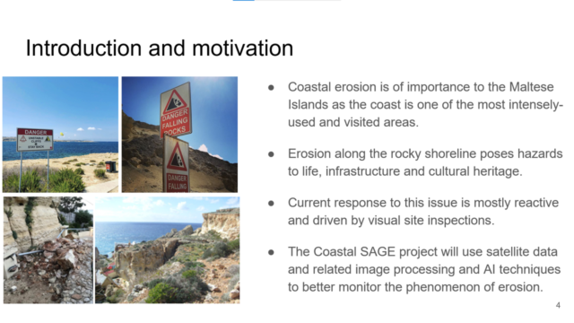
On the six testbeds, SAR data from Sentinel-1 satellites allow scientists to know exactly how the ground moves. By combining satellite data with in-situ observations and socio-economic data, the project will produce a risk assessment and monitoring tool to develop a preliminary coastal erosion management plan to be presented to public authorities and stakeholders. After completion of the project, the Ministry of Transport will be immediately able to use the plan to prevent the risks associated with coastal erosion around rocky beaches.
On another topic, the “Satellite4Health” project aims at forecasting the number of hospital admissions and the length of patients’ stay in hospitals, and at understanding the impact of weather and air pollution on the spread of diseases.
The project, implemented by a multidisciplinary team, was presented by Dr Lalit Garg from the University of Malta.
Satellite imagery is analysed to measure and monitor weather variables influencing public health, to assess the impacts of such variables on hospitals, and to finally develop a tool to forecast the number of admissions in the hospitals and the length of patients’ stay.
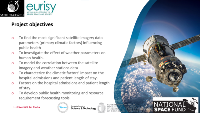
Weather data are collected through satellites (mainly Sentinel-3) and weather ground stations, while hospital data are collected directly from the Mater Dei Hospital and the Directorate for Health Information & Research (DHIR).
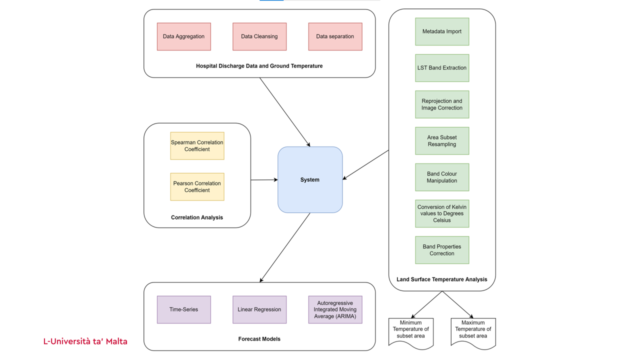
The system will allow to foresee the number of hospitals’ admissions and the length of patients’ stay based on weather data. This information will be disseminated through a mobile app that will alert users of events that can impact public health, such as sandstorms.
To know more about the activities of the MCST visit: https://mcst.gov.mt/
The presentations of the webinar are below:
SIPOBED Tha Malta Space Research Fund Eurisy_Introduction_to_Coastal_SAGE
Eurisy_Introduction_to_Coastal_SAGE
Satellite4Health – Eurisy Presentation
The recordings can be accessed here.
Stay tuned for the next webinar of the Eurisy Members’ Corner that will be hosted by the Slovak Space Office (SSO) on the 21th of October 2022 between 11:00 AM and 12:00 AM CET. To register: https://bit.ly/3dc3Aa8