Setting course for sustainable maritime activities
For our second event of Space Opportunities for Climate Challenges series, DotSpace and Eurisy covered the topic of Marine Environment. This monthly appointment brings together stakeholders from research, government and industry to talk about the use of satellite data tackling climate challenges. The platform gives them an opportunity to learn about funding calls and to discover opportunities for new collaborations.
Earth really is an ocean planet. The oceans cover 71% of its surface, containing 99% of the living space on Earth. Yet, today we have better maps of Mars than we do of the bottom of the ocean, which remains undiscovered for at least 80%. At the same time, the European Environment Agency recently pointed out that 93% of Europe’s marine area is under multiple pressures from human activities. European space assets, such as Galileo (Europe’s Global Navigation Satellite System) and Copernicus (Europe’s Earth observation programme), can help us to better understand and manage these congested marine areas.
Within its thematic area of Space for Maritime, Eurisy works to promote operational satellite-based services and share the experiences of early adopterssupporting the Blue Growth for Europe. Our database of success stories confirms the relevance of space for the management of maritime-related matters. By deep diving into professional communities beyond the traditional boundaries of the space sector, we collect user experiences. We try to understand their needs and challenges, and provide relevant fora where pioneering public authorities, agencies and SMEs from across Europe can share their hands-on experience. Watch the video below to know more about some of the success stories and tip us about your experience!
From monitoring coastal changes and fish farms to dark vessel detection
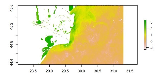
Scientific researcher in marine geology, Adriana Constantinescu, from the Romanian Institute of Marine Geology and Geo Ecology (GeoEcoMar) illustrated environmental and climate change impact in the Danube-Black Sea interaction zone. Coupled with in-situ measurements, Earth observation satellites provide good time series data of water constituents to understand the effects of climate change.
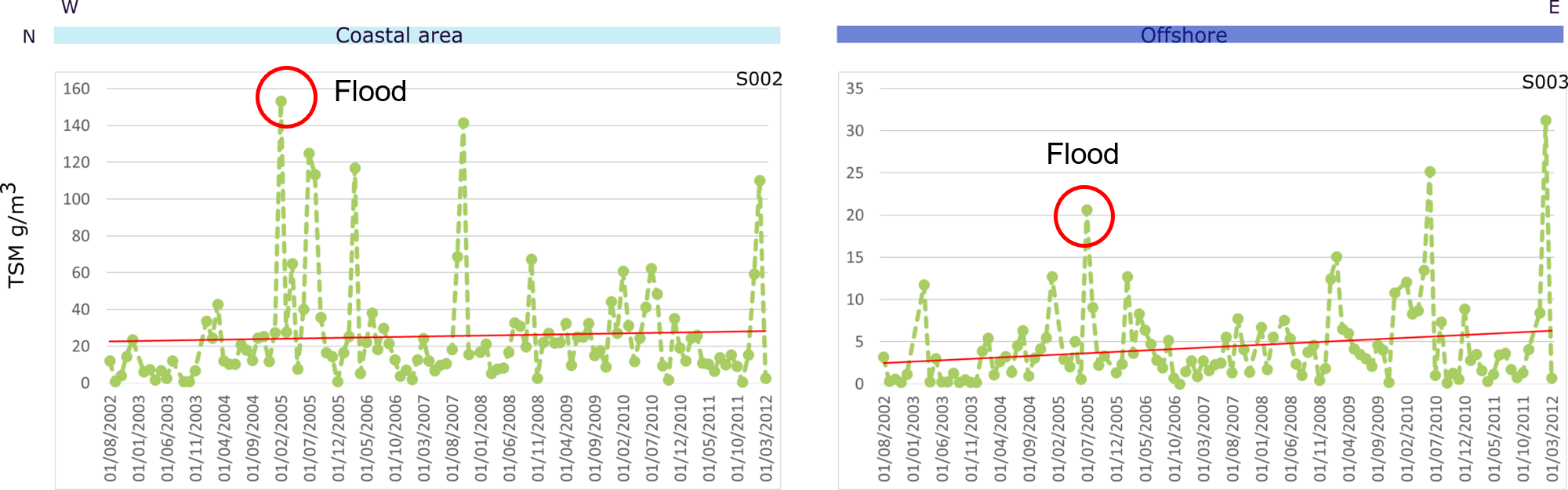 “It provides a very good tool to see how sediment fluxes are distributed, as well as to trace events like big floods and changes over time. This is how water minimum and maximum look like with satellite imagery from the CoastColour (Envisat) archive.”
-
- Water maximum
-
- Water minimum
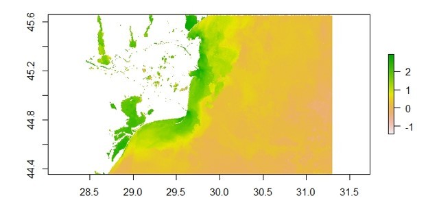
More water brings in more particles, but in this case, more chlorophyll, produced by micro-organisms living in the surface water, which can be an indicator for climate change. Since our seas and oceans are connected with the land through rivers and coastal areas, it is important to monitor these areas which are the main conveyer of water, sediment, and associated particles such as pollutants. Furthermore, Sentinel-3 data provides improved resolution to monitor coastal changes. Earth observation data enables continuous data with reliable spatial and temporal coverage and has become an important piece of the puzzle in marine research.
-
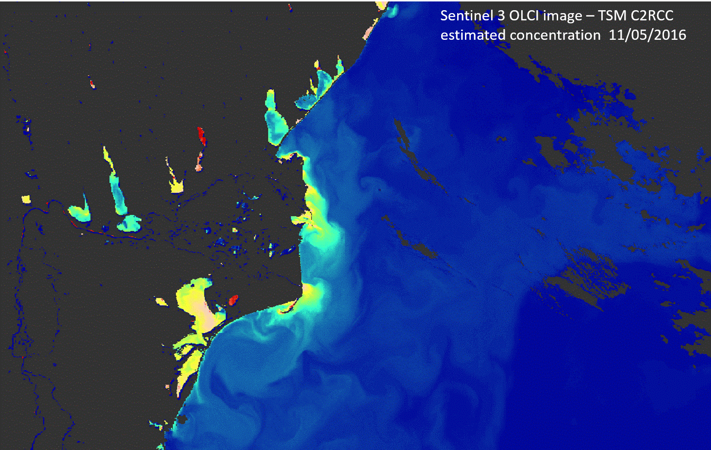
- Satellite imagery of water and sediment fluxes transfer to the Black Sea, tracing the distribution of the Danube plume and its effects on the coastal zone. This enables scientists to improve climate change analysis in transitional areas.
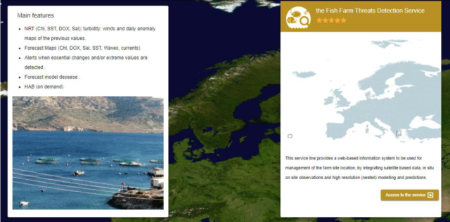
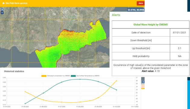
Daniela Iasillo, Technical Manager at Planetek, presented Marine-EO, the first Earth Observation Pre-Commercial Procurement. This project was founded to support European authorities to procure innovative Earth observation services. It implements a cloud platform for the provision of three Earth observation services, monitoring the marine environmental status (water quality), detecting fish farm threats, and the detection of vessels and icebergs in the Arctic zone.
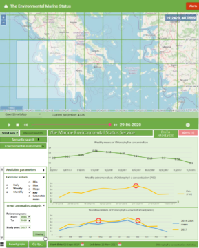
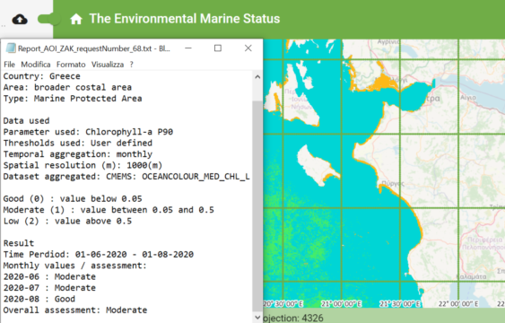
The services include numerous parameters such as chlorophyll, oxygen, salinity, sea surface temperature, wind speed, wave height, etc. The cloud platform has been deployed on CREODIAS, where the user can consult data about an area of interest during a certain period. Planetek’s commercial Rheticus platform will bring the services to the market.
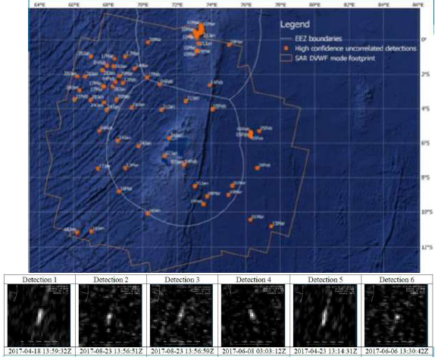
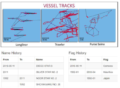
Jonathan Williams, CEO at Marine South East – a non profit industry association and member of the BlueTech Cluster Alliance – talked about marine protected areas, and in particular solutions against illegal fishing. With a combination of satellite images, automatic identification of shipping transmissions and AI analytics, so called “dark vessels” can be detected. These are vessels behaving suspiciously which can be an indicator for unlicensed catch. Moreover, by tracking a vessel it can be determined what kind of fishing it is undertaking from the nature of its tracks. The European Marine Safety Agency has also been very active in behavior analysis of vessels. The sharing of data among international databases is something which should be improved in order to catch up with the frequent changing identities of suspicious vessels. Satellite applications including Earth observation and tracking data are part of a broader portfolio of smart tools providing a decision support system for assets on the ground, such as patrol vessels and port states, to take action against illegal activities.
Funding & innovation opportunities
Some available funding opportunities have been illustrated, if you are interested and you would like to get to know more do not hesitate to contact us, suggest a topic or ask for any details you might need!
Sustainable Aquaculture from EIT, invites market-ready solutions to create quality food from aquaculture. The second call, BlueInvest Grants, is part of the European Maritime and Fisheries Fund (EMFF), helping SMEs to advance their market readiness of products and services. Other opportunities during the transition from H2020 to Horizon Europe could be LIFE, DestinE, and the European Maritime and Fisheries Fund.
The UFO Project is an SME Innovation Support programme seeking to support collaborative projects (of 2 or more SMEs) to develop products and services by integrating new technology solutions and know how in the Small Flying Objects (SFO) sector i.e. Smallsats, Drones and High Altitude platform systems. More information here.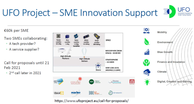
Another project creating opportunities for SMEs in the Blue Growth sector is Space2Waves. The Space2Waves project currently has a call to tender open looking for companies that can help with the training of SMEs and consultancy support for SMEs developing their internationalisation programmes. More information here. While the project is now closed to new applications having recruited its quota of 30 SMEs, it is still possible to sign up to the project Interest Group here.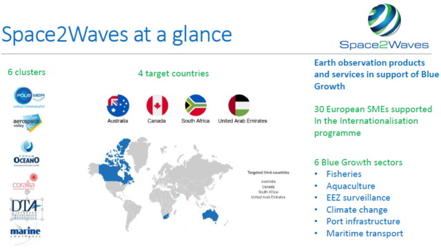
One-minute pitch
Finally, Marcel Kempers delivered a one-minute pitch about Reef Support, the Overall Winner of Copernicus Masters 2020. The company aims to take practical action in the blue economy by supporting reef conservation with space technology.
Anchoring Space Opportunities for Climate Challenges
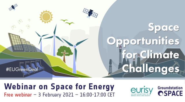
We are happy to announce that our series will continue for at least three more sessions! Next up is Energy, taking place on 3 February 2021. In march we will bring you more about Forestry, and in April we cover Water Management. Click on the image below if you would like to register for our next session.
Find all presentations of this webinar series here.