/

Solar Irradiance Nowcasting with Satellite Data

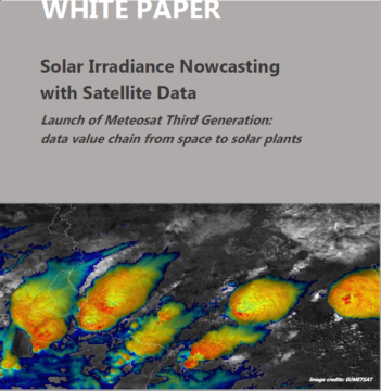
In this white paper, contributors Mathieu Turpin (Reuniwatt), Pilar Rípodas (AEMET) and Jochen Grandell (EUMETSAT) present the journey of satellite data from space to solar plant, following the launch of the Meteosat Third Generation Imager-1 (MTG-I1) – the first of a new generation of satellites providing crucial insights for the early detection and prediction of fast-developing severe storms, weather forecasting and climate monitoring.

This white paper highlights the accomplishments achieved through MTG characteristics, as well as the positive impact of the additional datasets and their improved quality and accuracy in solar irradiance forecasts in particular.

/

High Level Construction Forum: Webinars on innovation in the construction sector

On the 19 and 20 of October 2022, the High Level Construction Forum organised two webinars that
aimed to identify technologies that have the potential to advance the digital and green transition of
the construction ecosystem. It initiated an exchange on challenges and needs regarding research and
innovation, the uptake of technologies and the transfer of technology from research to market.

/

Integrating Satellite Applications in Disaster Risk Management

In recent years, Europe faced the consequences of several natural hazards, resulting in human and economic losses.
Extreme weather events due to climate change will only increase in the future. The rapid growth in the use of
satellite applications has the potential to mitigate the impact of climate change and related hazards. Earth
observations, Global Navigation Satellite Systems, and satellite communications all support crucial phases of
disaster risk management, from prevention and preparedness to response and recovery.

This paper aims to shed light on the European stakeholders playing a role in the disaster risk management cycle
and the contributions of satellite applications. It revolves around the current mechanisms to access and share
international and European space-born information. An analysis of the main stakeholders will be provided, as well
as their role and operative mechanisms. The research seeks to deepen the disaster risk management community
among European states with regard to the integration of satellite applications. Several recent case studies on the
use of satellite-based services during different disasters will be presented.

/

GIS4Schools – Paving The Way For The School Of Tomorrow: Leveraging On Space Technology To Stimulate Steam Learning And Teaching

Meeting the demand for STEAM skills in the job market is considered a priority in the European Union. The concerns related to the supply of STEAM skills rely on the educational offers from secondary schools and the propensity of pupils to follow a scientific course of study at the university level. Across Europe, every country is responsible for the definition and development of its methodological approach to enhance the teaching and learning of STEAM subjects. Because of its inspirational power, space can play a relevant role in attracting the young generation towards STEAM disciplines. Multiple projects have been developed at the European level to facilitate the familiarisation of pupils with STEAM topics by using space in combination with crucial challenges, such as climate change. An example of a project with such an objective is the Erasmus+ “GIS4Schools”. The project aims to improve STEAM learning paths in secondary schools, by promoting an innovative approach to the teaching of scientific subjects, while introducing the teaching of GIS and EO applied to the topic of climate change.

This paper is conceived as a follow-up of last year’s introduction to the GIS4Schools project to the global audience of the IAC. Leveraging in-depth interviews with the schools involved in the project and the data collected through the Digital Diaries, the paper will provide an analysis of the skills acquired by the pupils in the first half of GIS4Schools. In particular, the analysis will help to understand if the GIS4Schools products, as the Training Handbook and the use cases developed by each school, can constitute an autonomous teaching module to be integrated into existing teaching curricula. By retracing the latest developments of the GIS4Schools project, the paper will present the project as a case study for the development of future initiatives on the topic.

/

Messages to the above: looking at art from the sky

Eurisy aims at seizing the interest of the space community towards arts to launch a project specifically dedicated to “Space for Arts”. Today, the availability of new technologies and digital tools allows for unexpected synergies among artists and space experts. Indeed, the space sector is including arts among its areas of interest, as shown by the organisation of a session dedicated to Contemporary Arts Practice and Outer Space within the International Astronautical Congress. This interest is motivated by the multiplication of photographic, video and graphic experiences (also including VR and 3D), inspired or powered by space. Satellite imagery in particular, has been not only used to show the artistic beauty of the planet, but also to capture large artworks from the sky.

This paper provides a short introduction on how aerial photography and satellite imagery have changed our way of looking at the Earth, inspiring art movements and allowing for the discovery and appreciation of ancient and more recent artworks.

/

Space4Maritime: diving into space-based solutions for the maritime domain

Recently, Eurisy launched the initiative Space4Maritime. The objective is to identify and understand the needs of European maritime end-user communities, facilitating the dialogue with the space industry and the uptake of satellite services. In this frame, Eurisy started a series of interviews with end-users identified in the blue world. The result of these interviews is the core of the paper. The overall objective is to identify the existing operational solutions applicable in the maritime domain through practical examples, as well as the bottlenecks that harness the potential of satellite applications for the sustainable growth of the Blue Economy.

The paper will mainly address service providers and public authorities, providing them with a set of recommendations on how to foster cooperation with maritime operators. But it also targets potential new end-users interested in adopting satellite solutions in their workflow. The case studies will be complemented further by additional information collected through desk research and the organization of thematic webinars.

/

Improving STEAM Education in Secondary Schools through the co-creation of new methodologies for teaching GIS products related to climate impact on local communities

The improvement of STEAM education in secondary schools is the core objective of the Erasmus+ funded project “GIS4Schools”, which aims at promoting a new innovative approach to foster the teaching of STEAM subjects in secondary schools across four different European countries: Italy, Portugal, Romania, and Spain. The project intends to introduce the education of GIS and satellite technologies for Earth Observation- rarely adopted in secondary schools- and applying them to the thematic area of Climate Change.

The paper will illustrate the genesis of the project, and more specifically, the process leading to the development of training packages for secondary schools’ teachers and pupils. Furthermore, the paper will explore which methodology and pedagogic approach must be adopted to transfer new knowledge from teachers to pupils. The paper will also describe how the teaching of GIS and satellite technologies for Earth observation in secondary school can impact pupils’ perception of STEAM subjects and how this can impact their future academic careers. Specific attention will also be dedicated to the description of the innovative tools developed and applied for monitoring and evaluation.

/

UN/Austria Symposium: User-centric satellite solutions for effective climate actions

The 2020 UN/Austria Symposium “Space Applications for Sustainable Development Goal 13: Climate Action” took place from 1-3 September 2020.

The event aimed to showcase concrete climate action cases through demonstrations of applications using space solutions. Users of space applications presented lessons learnt and experts discussed the role of space applications in climate-related policies. On the 2nd of September, Eurisy gave a presentation on the basis of this abstract.

/

In space no one can hear the policy gap: barriers to wide scale adoption of satellite based services in Europe


European investments in space are expected to stimulate the development of the downstream value-added sector by boosting the large-scale adoption of satellite-based technologies to foster new, innovative services and deliver impactful socio-economic growth. Yet, their wide scale adoption and use has remained slow across various sectors and fields. Most often than not, public policies have played a bigger role in hindering satellite-based services adoption, rather than the perceived technology challenges themselves. The current paper reflects on the policy bottlenecks identified by Eurisy in telemedicine and emergency calling sectors. The paper was presented at the 70th International Astronautical Congress 2019, 21-25 October in Washington DC.

/

Space for all: how to connect space and society raising awareness on satellite applications for societal needs


Marking a decade in collecting user stories and testimonials on satellite-based applications, Eurisy looks back at lessons learned, analysing market and customer-service provider developments in Europe along the way. The paper details our user-centric approach which supports bridging the gaps between upstream and downstream satellite sectors and turns it into into a scalable model outside European borders. The paper was presented at the 70th International Astronautical Congress 2019, 21-25 October in Washington DC.

Load more